Rivers
Floods and heavy downpour in West Bengal in June 2011 - A rapid assessment report by Oxfam and Save The Children
Posted on 12 Jul, 2011 02:23 PMArticle courtesy: Corporate Disaster Resource Network
Assessment team:
Oxfam India – Mr. Pradeep Bharwad (Technical Assistance), Mr. Bhaswar Banerjee, Mr. Amit Sengupta
Save the Children - Mr. Abinash Lahkar, Mr. Piyush Kumar
Kajla Jana Kalyan Samity - Tapas Jana and Dipak Banerjee
Areas assessed: Moyna & Panskura Block of East Midnapore District of West Bengal
Assessment date: 24th June, 2011
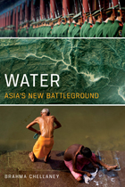
Water - Asia's new battleground by Brahma Chellaney: A new book from the Georgetown University Press
Posted on 12 Jul, 2011 01:48 PM The battles of yesterday were fought over land. Those of today are over energy. But the battles of tomorrow may be over water. Nowhere is that danger greater than in water-distressed Asia.
Analysing the role of geomorphic features in Kosi flood – An article in Geospatial World
Posted on 12 Jul, 2011 10:45 AMKosi is known as the sorrow of Bihar due to its frequent and often disastrous floods. The major geomorphic units of flood-inundated area in Kosi fan (terrain of Kosi river in India) are sand bars in the form of inter-connected drainage networks, an ox-bow lake and its meandering cut-off and imprint.
Himalayan solutions for cooperation and security in river basins : A report by Strategic Foresight Group
Posted on 29 Jun, 2011 07:03 PM This report by the Strategic Foresight Group is a follow-up to its earlier report The Himalayan Challenge: Water Security in Emerging Asia, 2010 . The growing water stress, plans for dams on shared rivers, and uncertainties about the precise impact of climate change have brought water to the forefront of the political agenda of countries in the Himalayan River Basins.
The report recommends policy options for national governments as well as strategies which can be implemented by local authorities and community groups in a politically viable manner. Some of the ideas may on the surface appear to be addressing micro-level issues. However, such micro-level issues do have an important bearing on security at the macro-level in a large continent such as Asia. This is the experience of many other regions as well, as illustrated in several of the chapters in this report.
The objective of this report is to explore how river basins in the Himalayan region, and particularly shared water resources, can foster cooperation and security between Bangladesh, China, India and Nepal. The conventional view is that depleting water resources, growing problem of pollution, uncertain risks posed by climate change together may lead to competition for resources, migration, social instability, internal conflicts and diplomatic tensions between countries. This view is realistic and was discussed in detail in a previous report of Strategic Foresight Group. It has contributed to spreading the awareness of security risks associated with water crisis in the Himalayan region.
Forget Prometheus and remember Bhagiratha: Wrong and right thinking about rivers ' - Shri Ramaswamy Iyer s lecture at School of Environmental Sciences, Jawaharlal Nehru University (June 2011)
Posted on 22 Jun, 2011 09:55 AM“Current economic philosophy exalts consumption and growth. If we are hypnotised by visions of 8% or 10% growth, we are bound to ‘demand’ more and more and still more water; and either government engineers or private companies and their engineers will come up with supply-side answers in the form of large projects which will cause even greater distress to the rivers”.
Tehri Dam across Ganga
Source: haridwar.nic.in/ gangaji.htm
I am very grateful to Prof. Sudha Bhattacharya for having invited me to this Seminar. I was not sure whether what I have to say would fit in well with the theme of this Seminar, but she persuaded me to say yes, and so here I am.
Biodiversity, ecology and socioeconomic aspects of the Gundia river basin in the context of the proposed mega hydroelectric power project - A CES technical report
Posted on 21 Jun, 2011 11:23 PMThis report by the Centre for Ecological Sciences, Indian Institute of Science, Bangalore highlights and argues for the the case of saving the Gundia river, one of the most important tributaries of the river Kumaradhara in Hassan district in Karnataka, which is known for its very rich vegetation and biological wealth. This is in the context of the proposal put forward by the Karnataka Power Corporation Limited to implement the Hydroelectric project (GHEP) on the river.
Down the drain – Exploring traditional water systems - A film by Tarun Jayaram
Posted on 21 Jun, 2011 10:41 AM
down the drain from tarun jayaram on Vimeo.
These are some of the questions which led Tarun Jayaram, the film-maker to explore traditional water systems in the country. From the documentary’s opening moments, the director engages us with a beautifully shot array of footages ranging from pilgrims taking a holy dip of Ganges to beautiful baolis and tankas of Rajasthan to the ancient town of Hampi in Karnataka, while establishing how rivers have been an integral part of Indian culture and how its rich tradition of harvesting rainwater needs to be re-established to deal with the present day water crisis. Over the refreshing images and soothing audio, it advocates the need for community participation in rejuvenating the traditional methods of rainwater harvesting.
Where our rivers begin - Water literacy for urban India
Posted on 20 Jun, 2011 12:37 PM
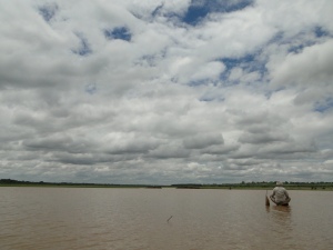
 Fisherman on Hessarghatta Lake on the Arkavathy River
It is here in a small pond that the Arkavathy river is famously said to originate. It moves down the hill in the form of a spring and enters the first of the man-made reservoirs, called ‘tanks’, the Chikkarayyappanhalli Kere. From thence begins the journey of this tributary to the Cauvery. Passing through a series of tanks built to hold its water for irrigation it comes to the large ‘Nagarakere’ at Dodballapur. The entire drinking water for the town of population 100,000 used to come from this large tank. Moving further on the river comes to the almost 7 sq.km. Large Hessarghatta tank. In 1894 this tank was enlarged and became the first external source of water supply to the city of Bangalore.
Union Cabinet approves amendment to Damodar Valley Corporation Act, 1948 in 2011
Posted on 17 Jun, 2011 04:03 PMThis approval is for the reconstitution of the Damodar Valley Corporation with four full time members, namely, Chairman, Member (Technical), Member (Finance) and Member Secretary; and six part time members, namely – one representative from the Central Government; two representatives – one each from the Government of Jharkhand and the Government of West Bengal; three independent experts- one each from the field of irrigation, water supply and generation or transmission of electricity. The Chairman will be the Chief Executive Officer of the Corporation. The posts of Financial Adviser and Secretary will be abolished.
MoEF signs three agreements with World Bank for cleaning Ganga and conservation of biodiversity in June 2011
Posted on 16 Jun, 2011 04:55 PMThe River cleaning project is to the tune of US $ 1 billion (approximately Rs 4,600 crore) loan and credit that will form part of the Bank’s long-term support for cleaning the Ganga River. Two Biodiversity Conservation agreements are for a credit of US$15.6 million and US$8.14 million grant.
On this occasion, Sh Jairam Ramesh , Minister of State for Environment and Forest Minister said, “Two protected areas, one each in Uttarakhand and Gujarat, will put in place a complete new model of managing the protected areas while safeguarding the livelihoods of local communities. So far local community was looked as enemies of protected areas, but this has to be changed. We have to make local communities full partners in the protection and regeneration of these protected areas. These new models will be applied in other areas of the country.” Giving details of cleaning operations of last few years, the Minister said, “The objective of Ganga project is ‘by 2020 no municipal sewage and industrial effluent will be let into the river Ganga without treatment’. With the help from the World bank, we are taking a big step forward in achieving the Mission Clean Ganga”.


