Rivers


Adaptive water resource management in the Lower Bhavani project command area in Tamil Nadu – A research report by IWMI
Posted on 25 Aug, 2011 11:07 PM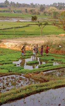
To what extent farmers and water resource managers already practice adaptive management and whether it is practiced in an optimal manner or could there be areas for improvement based on recent advancements in the theory of adaptive management are some of the questions that are particularly appropriate in the light of rapid changes in river basin water use and also in relation to basin closure.
This paper draws on the development and use of water resources in the Lower Bhavani Project (LBP), with the LBP reservoir and the 84,000 hectare (ha) LBP command area. The project diverts water from the Bhavani River, a tributary of the Cauvery River in Tamil Nadu.
Restructuring of the Central Water Commission – Ministry of Water Resources invites comments on its proposal till September 30, 2011
Posted on 25 Aug, 2011 12:24 PM
The restructuring is being proposed primarily to adopt river basins as the fundamental block for integrated planning, development and management of water resources in the country.
Boundary concepts for interdisciplinary analysis of irrigation water management – A working paper by Peter Mollinga
Posted on 24 Aug, 2011 07:16 PMThe focus is concepts that capture the hybridity of irrigation systems as complex systems, and cross the boundaries of the natural and social sciences.
Blue harvest – Inland fisheries as an ecosystem service – A report by UNEP
Posted on 24 Aug, 2011 11:34 AM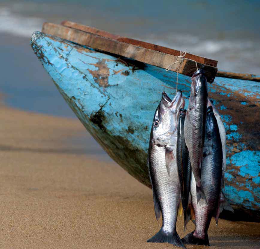 This report by United Nations Environment Programme (UNEP) reviews the importance of inland fisheries as an ecosystem service, the pressures upon them, and management approaches to sustain them and thus helps inform future approaches to conservation and management of freshwater ecosystems.
There is an urgent need for major investment in policy and management approaches that address the direct and indirect drivers of aquatic ecosystem degradation and loss of inland fisheries taking into account their role in sustainable development and human well being. The UNEP Ecosystem Management Programme (UNEP-EMP) provides an effective framework for pursuing this challenge.
Hydrology of the Upper Ganga river – A report by the International Water Management Institute
Posted on 21 Aug, 2011 10:43 PMTo provide the background hydrological information for the assessment of environmental flow requirements at four selected ‘Environmental Flow’ sites, a hydrological model was set up to simulate the catchment in the present state (with water regulation infrastructure) and to generate the natural flows (without water regulation infrastructure).
Fishing crafts and gear in river Krishna - Indian Journal of Traditional Knowledge
Posted on 21 Aug, 2011 10:40 AMThis paper published in the Indian Journal of Traditional Knowledge makes an attempt to record the fisheries related indigenous technological knowledge in terms of fishing crafts and gears used in river Krishna.
Fine-scale responses of phytoplankton to freshwater influx in a tropical monsoonal estuary following the onset of southwest monsoon – A paper in Journal of Earth System Science
Posted on 09 Aug, 2011 09:53 PMThis paper in the Journal of Earth System Science deals with a study by National Institute of Oceanography (NIO), Goa to investigate the influence of monsoonal rainfall on hydrographic conditions in the Mandovi River of India. The study was undertaken at a location approximately 2 km upstream of the mouth of the estuary.
Paleochannel and paleohydrology of Middle Siwalik (Pliocene) fluvial system in Northern India – A paper in Journal of Earth System Science
Posted on 09 Aug, 2011 11:41 AMThis paper in Journal of Earth System Science deals with paleochannel and paleohydrology of the Middle Siwalik (Pliocene) fluvial system in Northern India. In recent years, fluvial sedimentologists have carried out numerous studies to estimate quantitative hydrodynamics of ancient fluvial systems, particularly, their morphology and hydrology. The methods for reconstructing the morphology and hydrology employ either several groups of empirical relationships derived from modern fluvial environments or dynamic models of fluvial flow and sediment transports in alluvial reaches.
Establishment of missing stream link between the Markanda river and the Vedic Saraswati river in Haryana – A paper in Current Science
Posted on 05 Aug, 2011 04:11 PMThis paper in Current Science attempts to establish a missing stream link between the Markanda river and the Vedic Saraswati river in the plains of northern Haryana based on geoelectrical resistivity surveys. Resistivity surveys in the Gangetic Plains around Pehowa region in Haryana, have revealed different subsurface geological formations composed of fine, medium and coarse sand with gravel. Resistivity section between the lower part of the Markanda basin and the Saraswati river around Pehowa region indicates the presence of buried sand bodies connecting the two rivers.