Rivers
Tamirabarani, the perennial river in Tirunelveli district of Tamilnadu
Posted on 13 Jun, 2011 04:09 PMRiver Tamirabarani, a perennial river in Tirunelveli district of Tamilnadu. It originates from Pothigai hills in Western Ghat and drains at Punnaikayal afer running nearly 140 km. Its catchment gets rainfall during both SWM & NEM period. Ever year [or atleast once in every 18 month] the river is in full floods. During such period nearly 5000 cusec pure water is drained out to sea.
Godavari river water sharing accord - A paper by N. Sasidhar
Posted on 13 Jun, 2011 03:37 PMThe water availability in these projects has diminished to 33% dependability from the designed dependability of 75% in last nine years. Due to meager inflows, the river water quality is becoming unsafe for human and cattle consumption. It also suggests the remedial action to overcome the problem in future.
Why Mumbai must reclaim its Mithi – A study by Observer Research Foundation
Posted on 08 Jun, 2011 05:05 PMThe river, along with its estuarine reach, provides the much-needed green lungs to the city in the form of mangroves. Neglect of this river was the main cause of the catastrophic floods in Mumbai on 26 July, 2005, which claimed nearly 1,000 lives. In what could be a monumental urban transformation initiative to be undertaken anywhere in India yet, ORF has proposed a grand vision for the reclamation of Mithi River. The study report and a documentary film ’Making the sewer a river again - Why Mumbai must reclaim its Mithi’ on the dreadful conditions of the river, was released in May, 2011 in Mumbai.
Fluorosis in an urban slum area of Nalgonda - Andhra Pradesh - An epidemiological study - Indian Journal of Public Health
Posted on 07 Jun, 2011 10:09 AM.
ADB funded hydro projects in Himachal Pradesh: Disastrous experience - Press release by Him Dhara, SANDRP and HLJM
Posted on 06 Jun, 2011 06:07 PMReport questions ADB funded projects under the 'Himachal Clean Energy Development Programme'.
- ADB loans for four hydroprojects at eco-fragile zones
- Livelihood concerns and environmental issues un-addressed
- Section 17/4 – Urgency clause being used by HPPCL for forced acquisition of land
- Poor EIA reports and non compliance to environmental norms
Recently, a Public Hearing for the World Bank funded Luhri Hydro Electric had to be cancelled after public protests making it clear that the environmental and social impacts of Hydropower projects as well as the increasing gap between their promise and performance, especially in the Himalayan region have become issues of serious concern. And yet these projects continue to be promoted in the garb of renewable and clean energy. So much so that governments are borrowing millions of rupees from international banks and financial institutions to fund these so called 'green' projects.The four ADB financed hydro power projects being constructed by HPPCL include the 195 MW Integrated Kashang Stage I, II and III and the 402 MW Shongtong-Karccham in Kinnaur. The other two projects are the 111 MW Sawara-Kuddu hydropower projects in Shimla district and the 100 MW Sainj hydropower project in Kullu District.
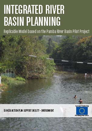
Integrated River Basin Planning – Experience on policy and practice in Pamba River Basin in Kerala – A report by APSF Environment Project
Posted on 30 May, 2011 09:50 PM The Pamba Pilot Project’s aim was to deliver “Policy Support to Integrated River Basin Management” and to contribute to the continuing EU-India policy dialogue in the water sector.
Analysis of TAC guidelines and decisions in recent meetings' - Dams, Rivers and People - Newsletter of SANDRP for April, May 2011
Posted on 27 May, 2011 01:26 PM
Newsletter of South Asia Network on Dams, Rivers and People (SANDRP) for April - May 2011 (Volume 9 Issue 3-4), focuses on the following topics.
- Analysis of TAC guidelines and decisions in recent meetings
The Advisory Committee in the Union Ministry of Water Resources for consideration of techno-economic viability of Irrigation, Flood Control and Multi Purpose Project Proposals (TAC in short) is supposed to discuss the techno-economic viability of the irrigation, flood control and multi-purpose project proposals as per the Resolution published in the Union of India Gazette Notification No. 12/5/86-P-II dated Nov 27, 1987.
Exhibition of "Dakshina Pinakini River Mapping and Landscape Survey"- An artistic intervention, 23rd - 26th May, 2011, Bengaluru
Posted on 26 May, 2011 01:23 PMVenue: Venkatappa Art Gallery, Kasthurba road, Bengaluru
Collaborated by: Subramani J, Ravikumar S M Halli & Shivaprasad S
Description:
The study focuses on Bangalore, highlighting its important rivers, lakes and its very lavish natural resources and how it is getting damaged due to its excessive urban growth and ignorance of the people. We started our documentation from Nandi hills to Hosur was our destination. Here we filmed and photographed various aspects of this river, the agricultural landscape and the urban scape. These documentations are archival materials, which have been focused during the process of research. Like how the death of a river takes place, where it used to begin and rebirth of the river due to the excess development of Broad Bangalore’s urban area.
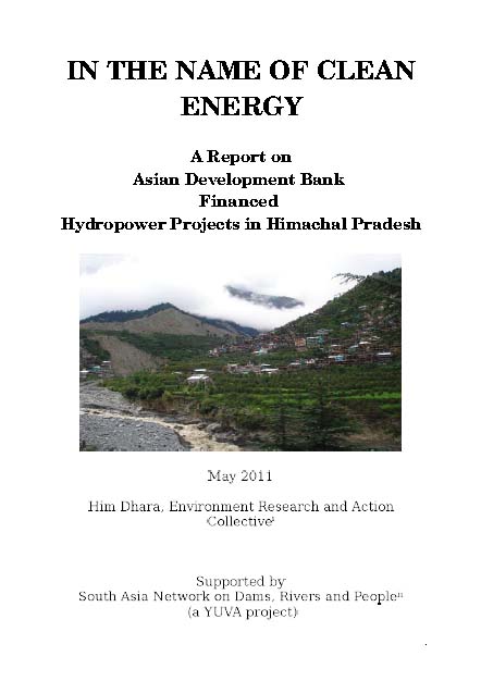
In the name of clean energy – A report on Asian Development Bank financed hydropower projects in Himachal Pradesh
Posted on 25 May, 2011 07:06 PM This report by Him Dhara, an environmental research and action collective, deals with the Asian Development Bank financed hydropower projects in Himachal Pradesh, which are leading to obstruction of the rivers and their consequent disappearance for harnessing energy and making ‘judicious’ use of the water. Within the hydro sector the attention has turned to the Indian Himalayan region which is estimated to have seventy nine per cent of the total hydropower potential of the country.
The technology of ‘run of the river’ (ROR) used to tap “the flow of rivers” in high gradient zones to generate power has given impetus to setting up of hydro-projects in the Himalayan states. In India, the mountainous region of the Himalayas offered the “perfect setting” for such projects, with the availability of several flowing water sources that could be tapped before they reached the plains. Of the Himalayan states, after Arunachal Pradesh, Himachal Pradesh is second in line with a hydropower potential of about 21000 MW. The installed capacity has increased twenty fold (from 326 MW to 6370 MW) in the last ten years indicating the frenzied pace of hydropower development in the state.


