Groundwater

Jobs via DevNetIndia dated 21 Apr 2010
Posted on 21 Apr, 2010 12:56 PM- Watershed Development Team Member (Forestry)
Antodaya
Location: Thuamul Rampur, Kalahandi, Orissa
Last Date: April 30, 2010
Evolving an integrated approach for improving efficiency of electricity-driven pumping of groundwater for agriculture - A discussion paper by CWS and Prayas
Posted on 20 Apr, 2010 06:57 AMThis study explores possibilities of local energy and groundwater management in Andhra Pradesh with the involvement of farmers for constructive contribution in improving the field situation in electricity supply and groundwater management.
Ground water pumping using electricity is a complex issue, leaving all actors - the farmers, distribution company, State government and environment conscious analysts - frustrated and dissatisfied. Farmers are frustrated with the poor quality of electricity supply, distribution companies with the low revenue, State government with the high levels of subsidy and the environmentalists with inefficient water use resulting in falling water tables. Level of mistrust between actors is also quite high. The process of evolving a sustainable solution is not clear.
In this context, this study by Prayas Energy Group and Centre for World Solidarity (CWS), explores:
- Grassroot and state-level insights, regarding electricity use and water management in agriculture
- Developing a simple methodology in consultation with farmers for collecting baseline field data and analyzing it towards improving the efficiency in a strategic way
- Possible areas of intervention in future
Estimation of replenishable groundwater resources of India and their status of utilization - A research paper by CGWB
Posted on 19 Apr, 2010 09:49 PMThe paper describes the methodology used in the groundwater resource estimation and the results of the latest country-wide assessment. In India, dynamic groundwater resources are estimated jointly by the Central Ground Water Board (CGWB) and State governments at periodic intervals. The latest estimates of dynamic resources are based on groundwater resource estimation methodology-1997 (commonly known as GEC-1997). These estimations are widely used in formulating various groundwater development and management plans. The paper also discusses future strategies on groundwater resource estimations.
Sustainable groundwater development through integrated watershed management for food security - A research report by ICRISAT
Posted on 15 Apr, 2010 04:45 PMThis paper by ICRISAT discusses the results from on-farm community watersheds through groundwater management as the drivers for sustainable management of watersheds in dry land areas. The issues of sustainable development and management of the groundwater resource through integrated watershed management (IWM) approach are also dealt with, in the context of food production and security.
Water Footprint Manual: State of the art - A method of water footprint assessment by the Water Footprint Network (November 2009)
Posted on 11 Apr, 2010 07:37 PM The Water Footprint Manual (2009) by the Water Footprint Network (WFN) is a comprehensive and up-to-date outline of the method of water footprint assessment. It introduces how water footprints can be calculated for individual processes and products, as well as for consumers, nations and businesses.
The concept is introduced as a comprehensive indicator of freshwater resources appropriation, as against the traditional and restricted measure of water withdrawal. The hidden water use behind products are measured over the full supply chain and water consumption volumes are measured by source and polluted volumes by type of pollution. All components of a total water footprint are specified geographically and temporally. Blue water (surface and groundwater), green water (rainwater stored in the soil as soil moisture) and grey water (polluted water) footprints are defined and are included along with the indirect water use in measuring the overall water footprints.
Joint Convergence Guidelines of the National Rural Employment Guarantee Act and Integrated Watershed Management Programme, issued by the Ministry of Rural Development (April 2009)
Posted on 09 Apr, 2010 09:36 PMThe Joint Convergence Guidelines issued by the Ministry of Rural Development (MoRD) in April 2009, attempts to bring about inter-sectoral convergence in the various watershed management programmes being implemented by the different departments under the MoRD. In particular, it deals with the convergence between the National Rural Employment Guarantee Act (NREGA) being implemented by the Department of Rural Development (DoRD) and the Integrated Watershed Management Programme (IWMP) being implemented by the Department of Land Resources (DoLR).
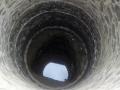
200 ft deep well needed for rain water storage so that it is used to recharge underground water pockets
Posted on 31 Mar, 2010 03:12 PMUse of rain water to recharge quickly the deep under ground water pockets
Present problem:
- Due to urbanization, many a under ground water recharge/enrichment points have be closed/covered/blocked. So, % of water reaching the underground water pockets is reduced to a very great extent.
- Bore wells are dug at a very large number to satisfy the increasing demand for water. Therefore, level of underground water table is going down alarmingly.
- As many the opportunities for the rain water to reach the underground level is blocked almost at all places, even with a little bit of rain, the water will run on the roads & cause artificial flood or water blocking at different points on roads or low laying areas of the Cities. Such floods are causing a lot of traffic jams/road mishaps.Rain water on the road is also damaging the durability of the TAR roads.
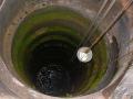
Using dried wells to enrich deep level under ground water pockets
Posted on 31 Mar, 2010 02:45 PMBy using dried open wells, we can enrich the Underground water quickly.
In the good old days, open wells used to help the common man in fetching water for all purposes and specially the drinking water. Invasion of pump-sets and specially the deep bore wells have pulled the underground water indiscriminately. Therefore, the water table level of the underground water is continuously going down at a very alarming rate. This fall in the underground water table level has made many a very big and useful water wells dry up. Now they are not in use as people do depend on alternative source of water like bore well water or the tap water drawn from far off river water.
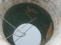
200 ft deep wells , in the corner of roads/parks , needed for rain water harvesting in cities
Posted on 31 Mar, 2010 11:51 AMRAIN WATER HARVESTING AT CITY.
LET US MAKE PLANS TO PRESERVE WATER AND SAVE THE ROADS.
Water is an important and essential commodity to every one which is to be preserved.
AT CITIES.
An innovative way of sharing diminishing groundwater introduced by APDAI
Posted on 27 Mar, 2010 12:55 PM“We no longer worry about the rains. We now have the confidence to grow alternative crops even if the monsoon fails,” said Balaraju, a farmer in one of the most drought-prone and economically vulnerable regions of Andhra Pradesh in southern India.