Surface Water


Basin maps of Krishna river showing basin indicators, landcover classes and biodiversity information and indicators
Posted on 17 Apr, 2009 01:25 PM
Basin indicators map of Krishna river basin
Basin maps of Indus river showing basin indicators, landcover classes and biodiversity information and indicators
Posted on 17 Apr, 2009 01:05 PM
Basin maps of Narmada river showing basin indicators, landcover classes and biodiversity information and indicators
Posted on 17 Apr, 2009 12:55 PM
Basin indicators map of Narmada river basin
Basin maps of Godavari river showing basin indicators, landcover classes and biodiversity information and indicators
Posted on 17 Apr, 2009 12:42 PM
Basin indicators map of Godavari river basin
Basin maps of Ganga river showing basin indicators, landcover classes and biodiversity information and indicators
Posted on 17 Apr, 2009 11:08 AMGanga river basin
Basin maps of Tapti river showing basin indicators, landcover classes and biodiversity information and indicators
Posted on 17 Apr, 2009 10:37 AM
Basin indicators map of Tapti river basin
Compilation of data for Cauvery basin for river basin planning along with maps of major river basins of India
Posted on 17 Apr, 2009 09:49 AMWater flows without regard to political and administrative boundaries. Water planning with respect to rivers should therefore be done for the river basin (or sub-basin) as a whole. River basin planning also has to look in an integrated way at all the relevant parameters like urban and rural populations, water usage patterns, water pollution, wastewater flows.
Umiam lake conservation -Stakeholder dialogue and future strategies, 9-10 March 2009, Shillong
Posted on 17 Apr, 2009 03:43 AMGuest Post by: Amitangshu Acharya The Umiam Lake Conservation - Stakeholder Dialogue and Future Strategies was held on 9th and 10th March 2009 in Shillong. The presentations and some videos from the conference can be viewed here -https://www.indiawaterportal.org/data/conf/ULC.html To give help learn more about the Lake Umiam in Shillong, here is a backgrounder about Lake Umiam and its importance to Shillong. You can join the discussion forum about Umiam Lake here https://www.indiawaterportal.org/Network/forum/viewtopic.php?t=3044 Umiam Lake ( also known as Barapaani) originated as an artificial reservoir for the Umiam Umtru Hydro Electric Power project, the first of its kind in the North East. For a long time, this project had supplied the bulk of its power needs to the State of Meghalaya. The state's love affair with this lake spans 43 years. With approximately 12,000 mm of rainfall each year and a catchment area of 221.5 sq km (almost double the size of Chandigarh) Umiam rarely saw any dry days. Until now, that is. For two years now, Shillong has confronted one of the worst power crises ever. The reason is not hard to imagine: Umiam doesn't have enough water. Officially, inadequate rainfall has been cited as the sole reason, and a correlation does exist between decreasing water levels (about 39 feet over 3 years) in the lake and lesser rainfall since 2005. And once the water level falls below 3150 feet, there can be no power generation. However, the question is, whether the role of rainfall is being overplayed while the other issues remains unaddressed.
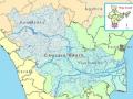
Cauvery basin: its culture, places of historical significance, birth place, climate, precipitation, catchment, tributaries, state-wise spread, landuse
Posted on 14 Apr, 2009 12:21 PMCulture and places of historical significance
The river Cauvery has been the inspiration for various civilizations who have thrived on the banks of the river. This can be seen manifested in the various forms of art, culture and philosophy that have originated along the course of the river.
Kosi Katha - The making of a famine': Video highlighting the growing famine in the wake of the floods in Bihar
Posted on 14 Apr, 2009 04:05 AM
The latest loss figures (24 Feb. 09 is five districts, 35 blocks, 33.29 lakh peopla, 9.97 lakh live stock., affected area 3.68 lakh hectares, 2.37 lakh houses, 527 human death a and 19,323 loss of cattle.