World Resources Institute
Mine the gap: Connecting water risks and disclosure in the mining sector – A report by the World Resources Institute
Posted on 17 Dec, 2010 10:43 PMThis paper by the World Resources Institute outlines potential water-related risks facing the mining industry and highlights important gaps in water-related disclosure. The purpose is to provide information, questions, and tools to help the financial community better evaluate water-related risks facing mining companies.
Basin maps of Mahanadi river showing basin indicators, landcover classes and biodiversity information and indicators
Posted on 17 Apr, 2009 02:07 PM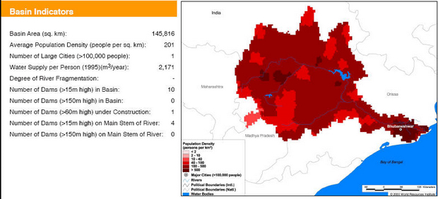
Basin indicators map of Mahanadi river basin
Basin maps of Krishna river showing basin indicators, landcover classes and biodiversity information and indicators
Posted on 17 Apr, 2009 01:25 PM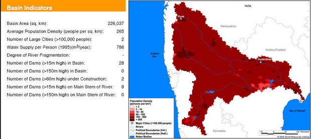
Basin indicators map of Krishna river basin
Basin maps of Indus river showing basin indicators, landcover classes and biodiversity information and indicators
Posted on 17 Apr, 2009 01:05 PM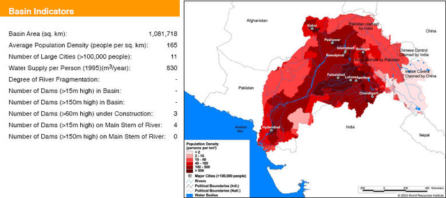
Basin maps of Narmada river showing basin indicators, landcover classes and biodiversity information and indicators
Posted on 17 Apr, 2009 12:55 PM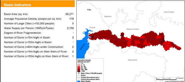
Basin indicators map of Narmada river basin
Basin maps of Godavari river showing basin indicators, landcover classes and biodiversity information and indicators
Posted on 17 Apr, 2009 12:42 PM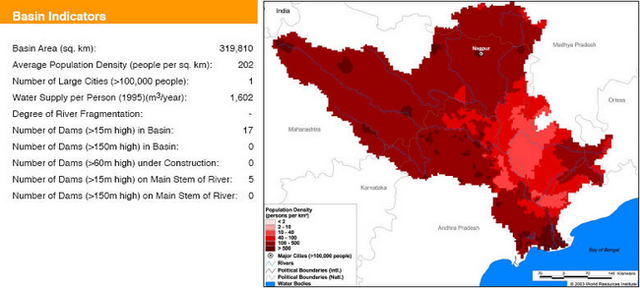
Basin indicators map of Godavari river basin
Basin maps of Ganga river showing basin indicators, landcover classes and biodiversity information and indicators
Posted on 17 Apr, 2009 11:08 AMGanga river basin
Basin maps of Tapti river showing basin indicators, landcover classes and biodiversity information and indicators
Posted on 17 Apr, 2009 10:37 AM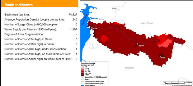
Basin indicators map of Tapti river basin
Compilation of data for Cauvery basin for river basin planning along with maps of major river basins of India
Posted on 17 Apr, 2009 09:49 AMWater flows without regard to political and administrative boundaries. Water planning with respect to rivers should therefore be done for the river basin (or sub-basin) as a whole. River basin planning also has to look in an integrated way at all the relevant parameters like urban and rural populations, water usage patterns, water pollution, wastewater flows.