Surface Water
Ecological Sanitation locations in India
Posted on 01 Dec, 2010 04:55 PMEcological Sanitation is a new approaching sanitation where there is minimal water use and where human waste can be used as fertilizer. It is a truly sustainable approach.
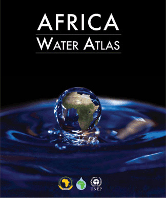
Africa water altas by the United Nations Environment Programme
Posted on 01 Dec, 2010 10:45 AMArticle and Image Courtesy: United Nations Environment Programme (UNEP)

This Atlas is a visual account of Africa's endowment and use of water resources, revealed through 224 maps and 104 satellite images as well as some 500 graphics and hundreds of compelling photos. However the Atlas is more than a collection of static maps and images accompanied by informative facts and figures: its visual elements vividly illustrate a succinct narrative describing and analyzing Africa's water issues and exemplifying them through the judicious use of case studies. It gathers information about water in Africa and its role in the economy and development, health, food security, transboundary cooperation, capacity building and environmental change into one comprehensive and accessible volume.
International Centre for Integrated Mountain Development (ICIMOD) is looking for Watershed Management Specialist
Posted on 29 Nov, 2010 04:09 PMContent and Image Courtesy: International Centre for Integrated Mountain Development (ICIMOD)
ICIMOD is a regional knowledge development and learning centre. We are working to develop an economically and environmentally sound mountain ecosystem to improve the living standards of mountain populations – now, and for the future. In line with its current Strategic Framework, ICIMOD is strengthening its capacity to develop new approaches to meet the growing challenges in the region posed by climate change and globalisation.
News roundup (16-22 November 2010)
Posted on 24 Nov, 2010 10:07 PMSanitation/Wastewater
- India tops the list of nations lacking toilets
- India hunts for a Rural Toilet Design, 1000 Euros up for grabs
- 82% of rural India deprived of three basic necessities of life — tapped drinking water, electricity connection and sanitation
- There are 700 million cell phone connections in India, but only half this number of Indians have access to private toilets, says a UN study
News roundup (8-15 November 2010) :"India proposes a new emission check system" and News round-up on the floods
Posted on 17 Nov, 2010 06:08 PMClimate Change
Environment
"Indian rivers have not been understood as ecosystems but are treated as conduits of water or wastewater" - Interview with Dr. Brij Gopal
Posted on 17 Nov, 2010 04:42 PMDr. Brij Gopal, Vice President, National Institute of Ecology and former Member, Working Group on Minimum Flows, constituted by the Water Quality Assessment Authority, talks to Parineeta Dandekar, India Water Portal about the urgent need of freshwater flows in Indian rivers, and the legal and institutional set ups required to ensure this.
GIS and Remote Sensing Techniques for Water Resources Assessment, IIT Madras, Chennai
Posted on 16 Nov, 2010 05:22 PM Organizer: Indian Institute of Technology - Madras
Venue: Indian Institute of Technology - Madras
Description:
The primary objective of this short term training program is to provide college teachers and professional engineers with a comprehensive understanding of GIS and remote sensing techniques relevant for studies related to water resources assessment.
Ecological destruction of Loktak, the largest freshwater lake in North East India – A five-part FES-InfoChange series
Posted on 13 Nov, 2010 07:18 PM This series by Thingnam Anjulika Samom deals with the impact of modernisation, development and state policy on the traditional use, control and management of Loktak lake, the largest common property aquatic resource in Manipur. The Loktak Hydropower Project commissioned in 1983 has damaged the ecology of the largest freshwater lake in the northeast, and has altered the culture, agricultural and livelihood patterns of communities residing around Loktak. The series looks at what this common property resource used to be and what it has become.
Loktak, the 300-square-km lake is spread over three districts in the valley – Imphal West, Bisnupur and Thoubal and covers 61% of the total identified wetlands of Manipur. Besides being the source of livelihood for hundreds of people, Loktak also houses the floating national park Keibul Lamjao, the only home in the world to the endangered Sangai deer. It is not only the geographical topography of the lake that has changed in the last few decades. The lake is also beset by increasing pollution, siltation, rapid proliferation of phumdis and the commissioning of the Loktak hydel project in the 1980s Manipur or Imphal River, with the Loktak lake forming the headwaters to provide regulated storage for power generation.
Storage above design full tank level in Pichola-Swaroop Saagar and Fatah Saagar lakes of Udaipur - A threat to safety
Posted on 10 Nov, 2010 10:02 PMThe historical lakes of Udaipur, Rajasthan, namely Pichola - Swaroop Saagar and Fatah Saagar are more than a century old. Filling them above original design full tank level on public demand or over enthusiasm may prove to be a threat to safety.
Training program on analysis and design of dams, NWA, Pune
Posted on 04 Nov, 2010 05:20 PMOrganizer: National Water Academy (NWA)


