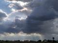
Rainfall and other forms of Precipitation

Bacteriological quality of water samples of a tertiary care medical center campus in North Western Himalayan region
Posted on 14 Aug, 2009 11:53 AMA study published in the The Internet Journal of Third World Medicine of bacteriological quality of water samples of a tertiary care medical center campus in North Western Himalayan region, more specifically in Kangra district of Himachal Prad
Baseline report: Sachetana Drinking Water project of the Government of Karnataka (2006-2011)
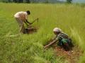
Posted on 14 Aug, 2009 11:28 AMThe Sachetana Drinking Water project of the Government of Karnataka covers 15 villages in each of the taluks of Bagepalli (Chikkaballapur), Mundargi (Gadag), Sira (Tumkur) and Pavagada (Tumkur).
The baseline survey covers a representative portion of the villages and families of the above and contains the following information:
Taluka wise daily rainfall figures for the latest monsoon from Gujarat State Disaster Management Authority
Posted on 13 Aug, 2009 05:03 PMThe Gujarat State Disaster Management Authority gives taluka wise daily rainfall figures for the previous monsoon (2007 currently) and comparison with the average of last ten years till the same date in the monsoon (June-Sept).
Preparation of guidelines for drinking water protection in Abadasa taluka in Kutch district of Gujarat
Posted on 13 Aug, 2009 01:07 PMThe report prepared by Arid Communities and Technologies (ACT) Kutch, Gujarat on behalf of Sahajeevan Trust aims to prepare a guideline for groundwater legislation to protect drinking water sources in the taluka.
Taluk level rainfall data and analysis for all the districts in Maharashtra from the state government's agricultural department
Posted on 13 Aug, 2009 12:57 PMThis page from the Maharashtra government's agricultural department site gives rainfall information upto taluka level (with data gaps for some periods) for the last 10 years
Status of groundwater in Wardha: A report from the Central Ground Water Board
Posted on 13 Aug, 2009 10:30 AMThis report from the Central Ground Water Board (CGWB) deals with the status of groundwater in the Wardha district of Maharashtra.
Taluka-level GIS database for Maharashtra, Karnataka and Madhya Pradesh
Posted on 13 Aug, 2009 09:47 AMThe taluka-level GIS database for Maharashtra, Karnataka and Madhya Pradesh, is a CD containing a GIS (Geographical Information System) database of the spread of and expenditure on watershed development programmes in 3 states of India, viz., Karnataka, Maharashtra and Madhya Pradesh.
Micro-watershed database for Maharashtra: Compilation by FoRWARD
Posted on 12 Aug, 2009 06:02 PMTo download the spreadsheet Click here
Chapter on water resources from the Chhattisgarh State of the Environment Report
Posted on 12 Aug, 2009 02:14 PMThe chapter on Water Resources from the Chhatisgarh State of the Environment Report, 2004 begins with a discussion of the problems in the State like (a) limited irrigation potential created (b) unbalanced irrigable land to cultivable land ratio in districts (c) low budget for maintenance of created irrigation facilities and (d) over-dependence on paddy cultivation.
Status of groundwater in Charama block of Kanker district, Chattisgarh: Report from Central Ground Water Board
Posted on 12 Aug, 2009 01:14 PMThe brochure provides complete information about the block and gives an overview of its geology as well as hydrogeology.
Pre-monsoon and post monsoon levels of water in the block have been mapped along with the hydrogeology of the region.
Download the brochure from link provided below