The term 'Disaster' occurs with such tragic frequency in news reports today, that it seems superfluous to define it. 'Official' definitions are suggested by the United nations and the Disaster Management Act. Simply put, a disaster is a rapidly occuring event that leads to loss of lives and property. Loss is the defining characteristic of a disaster. With the exception of industrial and other manmnade accidents, the cataclysmic events that lead to this loss are necessary landforming mechanisms.
Earthquakes, floods and resultant landslides, cyclones, and other such events are the processes through which the earth relieves pressure that might be building up in the crust, reforms river beds, and relieves buildup of atmospheric pressure. When humans are caught in the midst of these events and suffer damage and loss, the events are termed disasters.
It is not to be denied that these events can be catastrophic in their impact. The Bhola cyclone, in 1970, caused the deaths of 5 lakh people in India. Three decades later, the Orissa cyclone in 1999 killed 10,000 people.
1. Types of disasters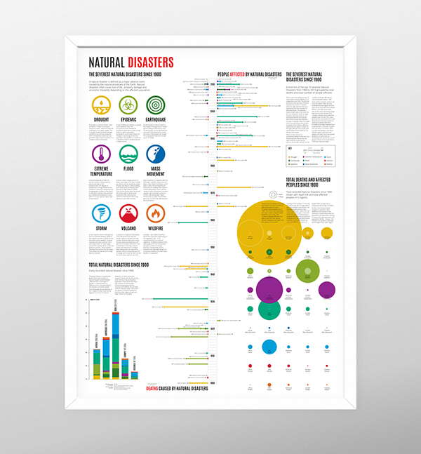
Disasters, events that lead to a considerable loss of life and property, can occur in several ways. The broadest means of classfication are as manmade and natural disasters. Manmade disasters include industrial and chemical disasters, stampedes, nuclear emergencies, transportation accidents (road, rail, air and sea), and mines. These, while important, are not withing the purview of the India Water Portal. The discussion therefore will be confined to natural disasters. Natural disasters of course can be exacerbated by human interference such as in the case of landslides which are intensified by blasting in mountain areas, and floods which are intensified by inappropriate channelization of river courses.
2. Dealing with disasters:
Traditional means of managing disasters has been confined to response. This is the rescue and aid that is given immediately after an event. In some cases, rehabilitation has been done, which is ensuring that the aid that disaster victims need to begin their lives over again is available. In recent years though, the purview of disaster management has expanded across the continuum of disasters to include mitigation and reconstruction. These now include:
- Prevention and mitigation
- Preparedness and response
- Recovery, reconstruction and rehabilitation
3. Institutional framework in India
Disaster management in India was earlier predominantly focused towards responding to requests for aid after a disaster. However, the nineties saw series of catastrophic events which led to the creation of a holistic policy of disaster management. The National Disaster Management Authority (NDMA) was established with the vision of a disaster- resilient India; created by enabling prevention, mitigation, preparedness, and effective response (National Disaster Management Authority, 2009). They recommend the inclusion of disaster prevention, mitigation and preparedness activities within the scheme of disaster management. The NDMA also recommends several measures at various levels from the national to the individual. A crucial part of these is the formation of State Disaster Management Authorities which oversee the implementation of the NDMA policies in their states. An important part of the institutional framework to deal with disasters is the emergence of community-led institutions. These range from pan-regional networks such as HYCOS in the Hindu Kush Himalayas to the village-based flood alert systems seen in Assam. These are explained in David Molden's talk below:
4. Voluntary organisations
Despite the existence of the National Disaster Response Force, the first responders on the scene are often local communities and voluntary organisations. The outpouring of support that one sees in the immediate aftermath of a disaster is a matter of pride for the nation, as citizens rally together to support the stricken communities. Local communities do stellar work in immediate rescue of afflicted people. This is especially crucial during landslides in the mountains when afflicted areas can be rendered inaccessible. Communities that are farther away from the scene of the disaster also rally around when it comes to the donation of supplies such as food, clothing and shelter. However this community-driven and impulsive response is largely confined to the rescue and response stages. The delivery of relief material can also be inefficiently handled due to the inexperience of the people dealing with the situation.
It is here that voluntary organisations come to the forefront. They usually have a network of contacts and are able to mobilise both goods and personnel in an efficient manner. Past disasters such as the Latur Earthquake, Leh Landslides, and Uttarakhand floods have seen all manner of voluntary organisations from NGOs to religious trusts offer support, time, and goods. Voluntary organisations also offer more than just the supply of immediately required food and clothing by assisting with construction of shelters, medical aid, and provision of sanitary facilities.
This is best offered by non-political volunteer networks and organisations that are largely devoted to the provision of disaster relief. These have access to highly skilled personnel, donor agencies, and government networks which enable them to provide superlative assistance as and when needed.
RedR is such a network composed of engineers. Volunteers with RedR participate in regular training which enable them to offer skilled assistance in times of disaster. Medicins Sans Frontiers is a network of doctors who provide skilled medical care in times of disaster and strife.
2. Personal responsibility
A large part of the casualties during disasters can be prevented by taking a few steps. After all, the first person present at the scene of an accident is the accident victim. While some events may have some warning, it is always better to be prepared for the unforseeable.
Please see below for some tips 'Do's & Dont's to protect yourself and your family in case of an emergency:
Earthquake Tsunami Landslide Biological Floods Cyclone Nuclear Heat Wave Chemical Disaster


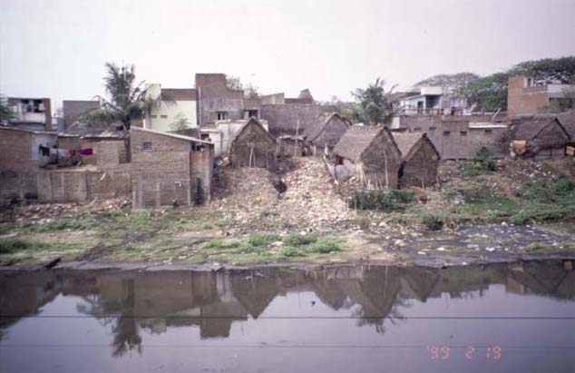 Two important metro cities of India, viz. Bangalore and Chennai are discussed. The aim of the study was to understand the problems of increasing flooding incidences in urban areas and related contexts of urban development and ecological issues. Data of secondary origin have been collected and interpreted in the context of flood risks and urban management. The paper also conveys wider issues and lessons for flood challenges in Indian cities and towns.
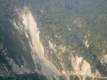 However, increasing anthropogenic intervention in the recent times appears to be contributing to terrain instability in addition to natural factors, as observed by increasing frequency and magnitude of landslides since 1970.
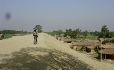 The Bagmati Embankment separating riverside on the left and countryside of the right near Ibrahimpur – Electric poles suggest the height of the embankment
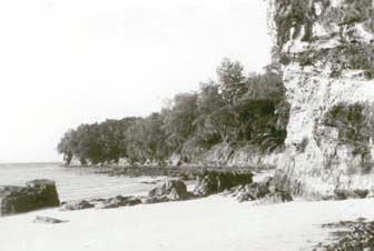 The historic tsunami of 2004 in the northern Indian Ocean severely affected the eastern coastal areas of peninsular India and Andaman-Nicobar Islands.