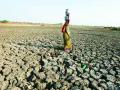
Droughts and Floods


Flood control regulation of a multi-reservoir system - A research report by National Institute of Hydrology
Posted on 26 Jun, 2010 01:41 PMThe report describes the software, which has been developed for flood control regulation of a system of reservoirs. The reservoirs can be gated or ungated, and the system can have any combination including weirs and diversions. For operation of reservoirs, the scenario has been divided into two categories depending on the reservoir level and inflows - normal operation and emergency operation.
The input data requirements of the software are modest. This software along with previously developed software for conservation operation would provide a complete set of tools to analyze any system configuration for the range of purposes for which reservoirs are commonly built in India.
Application of Geomorphological Instantaneous Unit Hydrograph and Geographical Information Systems based approach for flood estimation – A research report by National Institute of Hydrology
Posted on 25 Jun, 2010 10:33 PMThe study attempts to apply Geomorphological Instantaneous Unit Hydrograph (GIUH) and Geographical Information Systems (GIS) based approach for flood estimation. The design storm data of four catchments along with morphological characteristics have been considered. The geomorphological parameters and time area diagrams for each of the dam catchments were generated using the GIS package, Integrated Land and Water Information Systems (ILWIS).
The geomorphological parameters together with the time-area diagram forms an important input for the GIUH based Clark model. This model has been applied for deriving the instantaneous unit hydrograph and thereby to estimate the design flood in four dam catchments located in Luni and Chambal basins in Rajasthan viz. Jawai, Sei, Gamabhiri and Alnia. A review of the previous studies carried out using GIUH approach has been presented. Furthermore, a review of studies carried out using GIS techniques is also provided.
Simulation of flood hydrograph using an event based rainfall-runoff model - A research report by National Institute of Hydrology
Posted on 25 Jun, 2010 12:00 AMThe study deals with flood estimation through computation of a flood hydrograph for the ungauged Narmada catchment upto Jamtara using the physical and geo-morphological characteristics of the catchment. The catchment area of 17100 sqkm has been sub-divided into five sub-catchments for the purpose of flood estimation.
Drought characterization in sub-humid climatic region - A research report by National Institute of Hydrology
Posted on 22 Jun, 2010 03:37 PMThe study defines the climatic regions in terms of readily available climatic parameters like ratio of mean annual precipitation to global terrestrial mean annual precipitation and ratio of mean annual potential evapotranspiration to mean annual precipitation (Ep/ Pa).
The study focuses on the drought characteristics of the sub-humid climatic regions across different parts of the country. It establishes that the drought frequency and intensity have a significant relationship with the above regional climatic parameters. Average drought frequency (yr) is seen to increase gradually from dry to wet regions, from 4 years in the regions with Ep/ Pa ≥ 2 to above 8 years in the regions with Ep/Pa ≤ 1.
Drought studies for Kalahandi district in Orissa - A research report by National Institute of Hydrology
Posted on 22 Jun, 2010 08:13 AMThe study attempts to advance the understanding of regional drought phenomenon in the Kalahandi district of Orissa and present mitigation strategies. The dry spells during the monsoon crop growing season and wide variations in the quantum of rainfall from year to year result in frequent failure of crops in Kalahandi and as a result the district is categorised as drought prone.
Development of regional flood formulae using L-moments for middle Ganga plains – A research report by National Institute of Hydrology
Posted on 21 Jun, 2010 04:45 PMThe study develops regional flood frequency relationship and flood formulae based on recently developed efficient techniques of flood frequency analysis to estimate floods of desired return periods for small to moderate size gauged and ungauged catchments of the middle Ganga plains (sub-zone 1F) encompassing parts of Uttar Pradesh, Bihar and West Bengal. A regional flood formula has been developed by coupling the L-moment based regional flood frequency relationship with the regional relationship between mean annual peak flood and the catchment area.
Rainfall-runoff analysis using Flood Analysis and Protection Systems model - A research report by National Institute of Hydrology
Posted on 21 Jun, 2010 02:29 AMThe study applies advanced models of design storm like Flood Analysis and Protection Systems (FLAPS) and HEC-1 for rainfall-runoff simulation employing selected short-term events of three basins of the north-eastern region – Myntdu-Leska (Meghalaya), Krishnai and Dudhnai (Assam). The results are used to study the sensitivity of the model parameters with respect to different hydrological parameters of the basin. The performance of these methods is evaluated by analyzing the isolated events. An attempt has been made to evaluate the non-linearity in rainfall-runoff response, using a simple storage-runoff dynamic model. The relationship of incipient soil moisture and transmissivity with direct runoff and recharge is studied.
Hydro-meteorological inventory of Orissa cyclones - A research report by National Institute of Hydrology
Posted on 21 Jun, 2010 01:38 AMThe study is based on investigations and collection of necessary information on the super cyclone in Orissa in October 1999. It examines cyclonic phenomenon in the country in general and Orissa in particular, and stresses the need for preparing a comprehensive plan for dealing with such disasters.
Manual on drought management by the National Institute Disaster Management and the Ministry of Agriculture (2009)
Posted on 15 Apr, 2010 04:13 PM") This manual developed by the National Institute of Disaster Management (NIDM) presents a comprehensive approach to drought management and recommends measures that can be implemented for effective drought relief and mitigation. It brings together conceptual issues, institutional framework & operational details, and replaces the colonial famine codes written largely for dealing with hunger and starvation.
This manual developed by the National Institute of Disaster Management (NIDM) presents a comprehensive approach to drought management and recommends measures that can be implemented for effective drought relief and mitigation. It brings together conceptual issues, institutional framework & operational details, and replaces the colonial famine codes written largely for dealing with hunger and starvation.
It has been prepared with the objective of creating synergy between the various programmes being implemented to provide drought relief and mitigation by several levels of government.
The key issues covered in the manual are:
Climate change impacts in drought and flood-affected Areas: Case studies in India - A report by the World Bank
Posted on 11 Apr, 2010 03:50 PMThis report by the World Bank discusses the climate changes in India and the disasters associated with these climate changes such as floods and droughts and their negative impact on agriculture, food production, livelihoods, security and the condition of the vulnerable groups in the country. The report goes on to discuss the policies undertaken by the Government of India to deal and adapt with these changes and the challenges faced in implementing these policies.