Haryana
Integrated groundwater resources mapping in Gurgaon district, Haryana
Posted on 19 May, 2009 01:47 PMThis paper from the GIS Development site mainly deals with the preparation of integrated ground water resource (IGWR) map indicating ground water prospects, quality and depth.
Hydrogeomorphological mapping of Panchkula district in northern Haryana- a study in GIS development
Posted on 19 May, 2009 12:11 PMThis study from the GIS Development site is an attempt to use remote sensing techniques to prepare hydrogeomorphological maps of the Panchkula district in the northernmost part of Haryana to delineate the
Integrated and sustainable rural water management for improving water quality in Mewat, Haryana
Posted on 18 May, 2009 04:06 PMThis paper published by the Sehgal Foundation presents a case
Sustainable rural water management - a replicable case study by the Sehgal foundation
Posted on 14 May, 2009 03:12 PMThe case study is on integrated water management in village Ghaghas, Haryana, which is replicable in general, though micro conditions in villages would be different. Often the failure of water management structures is due to lack of design for silt management.
Harvesting water harnessing life: A case study of Kotla village in Mewat, Rajasthan
Posted on 14 May, 2009 01:31 PMHARVESTING WATER HARNESSING LIFE
A Case Study of Kotla Village in Mewat
MEWAT: STATISTICS AT A GLANCE
| People | Meo Tribals |
| Geographical Location | Foothills of Aravalis |
| Average rainfall | 336mm-500mm |
| Occupation of villagers | |
| a) Agriculture & Animal Husbandry b) Others | 58% 42% |
| Cultivated area | 80% |
| Irrigated area | 44% |
| Source of water for irrigation | Ground water- 95% |
| Water Quality | Mostly brackish |
| Ground water depletion rate | Over 25cms a year |
MDA & IRRAD : Water projects in Mewat
Posted on 07 May, 2009 10:11 AMFrom: IRRAD Connect Volume 6 Image & Content Courtesy:IRRAD 
In Mewat, the ground water is depleting at the rate of about 25 cms a year and salinity is increasing in many parts. The rising water salinity is affecting crop yield and limiting the choice of crops that can be grown. About 80% of the total geographical area in Mewat is cultivated. Of this total cultivated area, only 44% falls under the irrigated area, the rest is rain fed area. For the irrigated area the source of water is almost exclusively (95%) ground water, but it is very limited, generally enough only for one crop a year. It also includes pockets of saline water which is not fit for cultivation of most of the crops grown in that area. About 30% of households own wells or tube wells. Fast ground water depletion and seasonal variation of tube well yields is a matter of concern leading to low crop intensity. This is especially true in the villages where IRRAD is working. To check these rising water concerns a tailor made, integrated water management plan was needed for each village, with the first step being the study of topography, water flow, soil characteristics and traditional knowledge. Subsequently, the designing of appropriate interventions to harness and conserve water is undertaken. To this effect, IRRAD has carried out technical interventions like the check dams, gully plugs, recharge wells, soak pits, roof water harvesting etc. Taking water as an entry point of development work, IRRAD has intervened in many villages, expanding its activities to 17 villages.
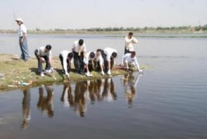
Agra: Yamuna river trash cleanup 2009
Posted on 23 Apr, 2009 11:45 AMAhead of the Lok Sabha polls, hundreds of students of several schools along with senior citizens cleaned up Poiya Ghat Sunday morning, picking up rags and used polythene bags, to focus attention on river pollution which candidates of various political parties have chosen to ignore.
Brij Khandelwal, programme convener of the Yamuna Foundation and Rivers of the World Foundation, said apart from students involved in the My Clean Agra initiative, a large number of other voluntary groups and organisations were involved in Sunday's programme which specifically targeted the politicians for failing to clean up the cities and the rivers of India.
"No political party has bothered to say a word about how they would save a dying river and rejuvenate it or restore its original glory," said Subhash Jha and Haridutt Sharma of the Yamuna Foundation for Blue Water.
