The Central Ground Water Board (CGWB) under the Ministry of Water Resources has released a publication entitled “Aquifer systems of India” apart from aquifer atlas for six states viz. Kerala, Tamil Nadu, Karnataka, Chhattisgarh, Himachal Pradesh and Meghalaya. The Minister of State for Water Resources and Parliamentary Affairs, Shri Pawan Kumar Bansal released the atlas based on enormous data generated by Central Ground Water Board on various aspects of groundwater in New Delhi recently.
The atlas provides a country wide overview and summary of the most important information available for all principal and major aquifer systems and depicts aquifer wise ground water scenario. It also deals with major issues and challenges which need immediate attention for sustainable management of groundwater resources.

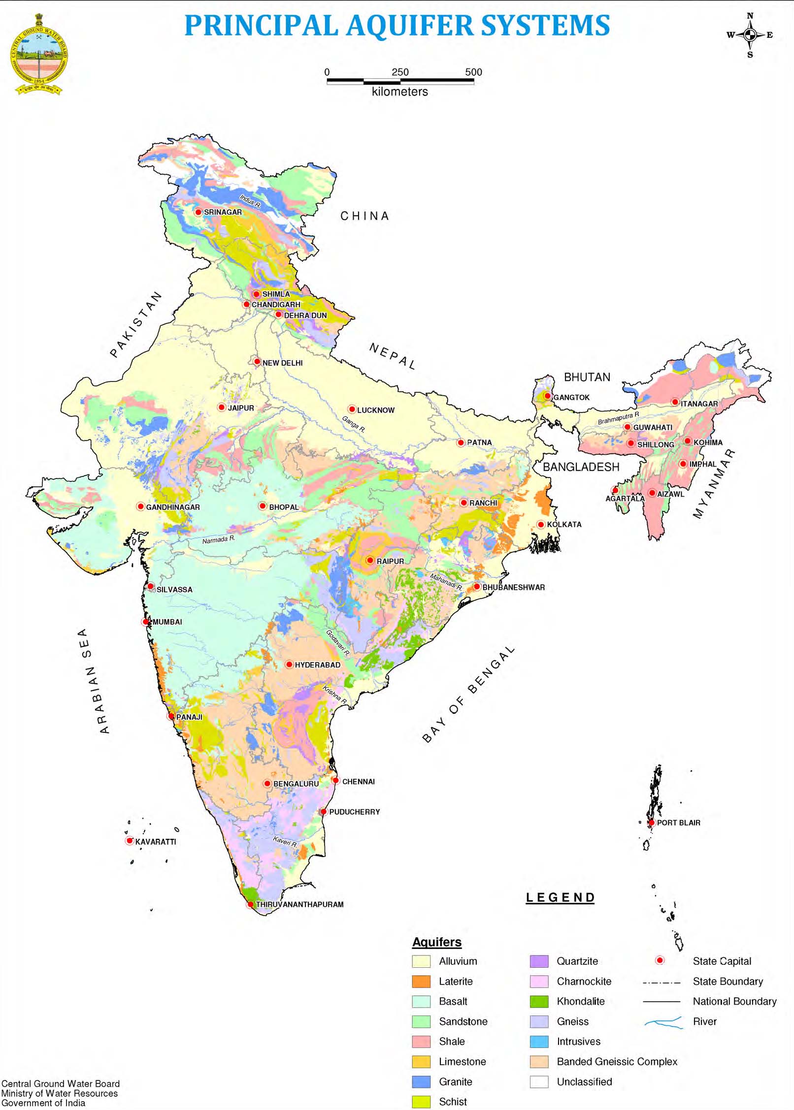
Principal aquifer systems of India
Image courtesy: Aquifer systems of India, Central Ground Water Board, 2012
This compilation provides valuable information on the areal and the vertical extents of major aquifers and their characteristics. This is expected to serve as the foundation for the National Aquifer Mapping Programme being contemplated during the XII and XIII plan period that aims at detailed mapping of the aquifer systems on 1:50,000 or larger scales.
However considering the diversity of geomorphic and hydrogeological settings and the hydrochemical variations in the aquifers systems in the country, the present compilation is the starting point to formulate micro level strategies for ensuring long-term sustainability of ground water resources. The compilation has been done on 1:250,000 scale by integrating the geological and hydro geological data of CGWB & GSI respectively and various other ground water related thematic data/information from other agencies.
In order to carry out the present exercise all the data generated by CGWB along with the data collected from different agencies is integrated in GIS platform. The outputs are depicted as thematic layers with location of groundwater wells, exploratory wells, groundwater quality hot spots in terms of high incidence of geogenic contaminants, stage of groundwater development etc., in different maps. Detailed accounts of the aquifer types, their characteristics and spatial extents are given in the atlas. Attempt has also been made to delineate aquifer wise areas suitable for conservation, recharge as well as exploitation of groundwater. Simple presentation of tables is used to explain aquifer wise groundwater scenario in the country.

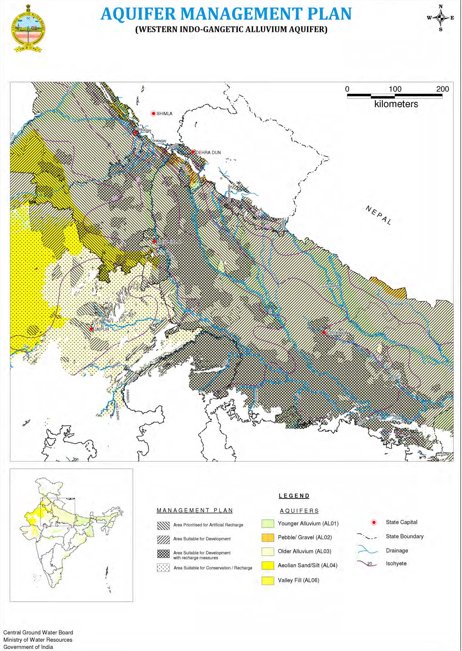
Aquifer management plan - Western Indo-Gangetic Alluvium aquifer
Image courtesy: Aquifer systems of India, Central Ground Water Board, 2012
Based on the hydrogeological characteristics, the entire country has been classified into 14 principal aquifer systems and 42 major aquifers. Alluvium is the major aquifer system which covers maximum area of around 31 per cent of the entire country and is available in Uttar Pradesh, Bihar, West Bengal, Assam, Odisha and Rajasthan. The sandstone aquifer covers around 8 per cent area in the country and is available in Chhattisgarh, Andhra Pradesh, Madhya Pradesh, Gujarat, Karnataka and Rajasthan.
The rest of the country is covered with the other formations that cover around 60 per cent of the area. Among these, basalt aquifer covers maximum of around 17 per cent area of the country and is available mostly in Chhattisgarh, Andhra Pradesh, Madhya Pradesh, Rajasthan and in the north eastern states as well as in the Himalayan terrain. Limestone aquifer covers a very small area of around 2 per cent in the country and is mainly available in the states of Chhattisgarh, Andhra Pradesh, Karnataka and Gujarat and in the Himalayan states.
Around 20 per cent of the area of the country is covered by banded gneissic complex (BGC) and gneiss aquifers which are available almost in all the peninsular states as well as the Himalayan states. The rest 15 per cent of the entire area is covered by aquifers namely; schist, granite, quartzite, charnocktite, khondalite, laterites and intrusive.
In Chhattisgarh, the annual replenishable ground water resource has been estimated as 12.22 bcm out of which 11.58 bcm is considered to be available for development for various uses after keeping 0.64 bcm for natural discharge during non monsoon period for maintaining flows in springs, rivers and streams. The state as a whole has a stage of development of only 31.04 per cent.
For Himachal Pradesh, the analysis of the exploratory wells data indicate that in Una, Nallagarh and Indaura valleys, granular zones are limited to 150 m depth. The long term water level data analysis indicates that general water level in the valley varies from 5 to 10 m bgl. Deeper water levels of more than 20m have been reported from the Kala Amb valley. The quality of surface water, spring and groundwater of various depths is good and suitable for irrigation, domestic and drinking uses. All the chemical constituents are within permissible limits as per BIS standards except at few localized pockets in industrial areas of Baddi-Barotiwala in Solan district. The total groundwater resource estimates of eight valleys of the state as on March 2009 reveals that overall the stage of groundwater development is under safe category, except in Kala Amb and Una valleys wherein groundwater is highly exploited for irrigation and industrial uses.

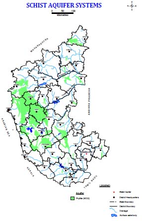
Schist aquifer systems of Karnataka
Image courtesy: Aquifer systems of Karnataka, Central Ground Water Board, 2012
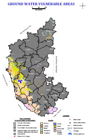
As regards Karnataka, major part (99 per cent) of the state is occupied by hard rock aquifers leaving a small part of the coastal terrain, which is occupied by alluvium. The state is dependent on ground water for its all round development. There is a spurt in groundwater development since the 1990 and the same is more pronounced in some of the districts like Bangalore, Belguam, Chickballapura, Chitradurga, Kolar, Ramanagaram and Tumkur. Consequently, there was a steady decline in the water levels resulting in drying up of dug wells and shallow bore wells. About 66379 sqkm (35 per cent) of the area of the state is over-exploited. In about 12930 sqkm (7 per cent) of the area, the stage of development has touched critical level, as per the state atlas.

Groundwater vulnerable areas of Karnataka
Image courtesy: Aquifer systems of Karnataka, Central Ground Water Board, 2012
The stage of groundwater development for Kerala as a whole has been computed as 47 per cent. The utilization pattern is, however, uneven across the State, with groundwater stressed conditions in some parts and sub-optimal groundwater development in some others. Out of the total of 152 assessment units (blocks) in the State for which the assessment was carried out, Chittoor block of Palakkad district has been categorized as ‘Over-exploited’, whereas Malampuzha block of Palakkad district and Kasaragod block of Kasaragod district have been categorized as ‘Critical’. A total of 23 blocks located in different districts have been categorized as ‘Semi-critical’ and the remaining 123 blocks as ‘Safe’. In spite of the relatively low level of ground water development in the State, problems related to shortage, mainly for drinking and domestic uses and contamination of water due to natural and anthropogenic causes are felt in different areas of the State.
One of the world's wettest regions is found in Meghalaya. Geologically, the State is occupied by unconsolidated, semi-consolidated and consolidated rock formations, ranging in age from Archaean to Recent. Hydrogeological units occurring in this hilly state of Meghalaya are heterogeneous and complex in nature. Ground water is found to occur under confined to unconfined aquifer conditions within 300m. In Meghalaya, ground water is generally extracted through dugwells and springs (or seepage wells in valley areas/topographic depressions) and bore wells. Apart from this, tubewells are in use in West Garo Hills district. Dugwells are generally shallow in depth varying from a meter to 6 mbgl. Bore wells are drilled up to 200 m bgl.
Tamil Nadu State is underlain by diverse hydrogeological formations, nearly 73 per cent of the state is occupied by hard rocks, the semi consolidated and consolidated formations are mainly confined in the eastern part which is the coastal tract. In the hard rock area, groundwater is mainly developed through dug wells and dug cum bore wells tapping the weathered zone, the yield of open wells vary from 1 – 3 lps, whereas in dug wells tapping soft rocks including sedimentary formations, the yield is up to 5 lps. Dynamic ground water resources have been assessed block-wise and during the recent resources estimation (2009), the Annual Replenishable Ground Water Resource of the state has been estimated as 22.94 bcm and Net Annual Ground Water Availability is 20.65 bcm. The Annual Ground Water Draft is 16.56 bcm and Stage of Ground Water Development is 80 per cent leaving limited scope for further development of the dynamic ground water resources.
An attempt has been made to prioritize areas based on the sustainability and quality related groundwater issues and presented in the atlas. Various groundwater management strategies have also been suggested. This atlas will be very handy tool for academia at the institution level and the next step would be to provide such data to the farmers in the country so that they can derive maximum benefit out of those available data, the Minister of State for Water Resources said while releasing the atlas.