Surface Water


World Wetland Day 2010 Celebrations - Updates from ATREE
Posted on 24 Mar, 2010 05:21 AM![]()
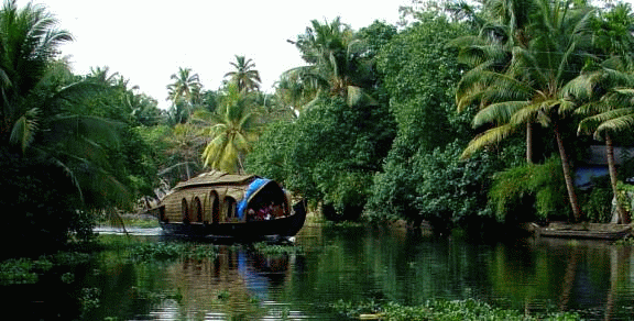 The World Wetland day 2010 was celebrated by CERC-ATREE with a number of programmes. As an Annual event ‘WETLAND FESTIVAL 2010’ involving the students and teachers from the wetland clubs of Jalapadom schools around the Lake, was held at Kalyani auditorium, Aleppey.
Barrages as a better alternative to Polavaram dam project
Posted on 20 Mar, 2010 06:34 PMBARRAGES AS A BETTER ALTERNATIVE TO POLAVARAM DAM POJECT
(Replies to Discussion Report of Advisory Committee on alternate proposals made for
Polavaram project by Sri.T.Hanumantha Rao, former Engineer-in-Chief, AP State)
Workshop on Protecting water bodies of Chennai, ASCE-EWRI, Chennai
Posted on 20 Mar, 2010 10:05 AMThe first international chapter of Environmental and Water Resources Institute of the American Society of Civil Engineers, ASCE - EWRI South India Chapter was inaugurated at IIT Madras on January 6th 2010.
Achieving drinking water security through participatory IWRM approaches in Dhasan sub-basin - A case study by WaterAid and Haritika
Posted on 20 Mar, 2010 04:05 AMThis presentation describes the work of WaterAid and Haritika in organising drinking water security through Integrated Water Resource Management (IWRM) approaches, in Dhasan river sub-basin (part of Bharar river basin), Nowgon block, Chattarpur district of Madhya Pradesh.
The wells brim with water in drought-prone Gujarat
Posted on 19 Mar, 2010 09:20 AMTHE WELLS of Kalawad village in Junagadh district, Gujarat brim with water. The reason — construction of check dams by a peasant, Mr.
Action plan workshop for the rejuvenation and sustenance of the Arkavathi river basin - Discussion summary and research papers (2009)
Posted on 12 Mar, 2010 04:14 AMA one-day “Action plan workshop for the rejuvenation and sustenance of Arkavathi river basin”, was organised on 25th July 2009, by the Global Academy of Technology and Geological Society of India at Bangalore, to discuss the future of the dying Arkavathi river and Bangalore's precarious water situation, and to develop concurrent implementable action plans to address the problem. The Arkavathi is a tributary of the river Kaveri, originating in Nandi Hills in Chikkaballapur district, that provides about 20% of the total water requirements of Bangalore, with Kaveri providing the remaining 80%.
Jaltarang, a celebration of World Wetlands Day - An update from TERI's wetland management program in Navi Mumbai
Posted on 11 Mar, 2010 10:45 PM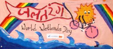 The satellite township of Navi Mumbai, with a total area of 344 km2, was developed in 1972 by CIDCO (City and Industrial Development Corporation) to de-congest the city of Mumbai. Initially a marshy land interspersed with villages, Navi Mumbai has been developed into a planned township, with much of its marshes and freshwater wetlands being converted into urban infrastructure.
Navi Mumbai is a rapidly developing twin city. In the course of development, it was realized that more emphasis needs to be given towards the preservation and sustainable management of the freshwater wetlands it harbours. Given the vulnerability of these wetlands and their resource potential, there is an urgent need to develop a framework for sustainable use of freshwater wetlands. This requires efficient management systems and development of sustainable models, which would help maintain the natural characteristics of wetlands while also exploiting its potential to meet the socio-economic and recreational needs of communities. To tackle this important aspect, TERI conceptualized a pilot project with active support of CIDCO in October 2008. The Khandeshwar Lake was chosen as a model to demonstrate the feasibility as a ‘sustainable wetland’.
The attached presentation is an update on the work taken up and impact achieved since the start of the project, and includes details from the World Wetlands Day celebration organised on 2 February 2010. Details of TERI's wetland management program are here.
The Vand women of Kachchh - A case study on drinking water management from the work of Samerth Trust in Kutch, Gujarat
Posted on 07 Mar, 2010 02:23 AMThis case study is about Samerth's efforts to achieve drinking water security, in participation with local village communities in Rapar, Kachchh (Gujarat). Arghyam has been collaborating with Samerth on this effort since 2007.
The Vand Women of Kachchh: Guest post by Keya Acharya
She gazes unflinchingly with direct eyes into the camera with a feminine mystique and physique that could, be gracing the front cover of a beauty magazine. Her red, mirror-worked blouse, in the traditional Kachchhi style worn by tribal women, is strapped at the back in stringed bows, greatly practical in the dry, wilting heat of that arid expanse of land in hinterland Gujarat called Kachchh. Her skirt is a colourful hue of printed green, and her ‘dupatta’ is a blazing red piece of cloth swept forward from her waist, partially covering her back, brought over her head and tucked back demurely into her waist again. Her name is Ammi.
Entry 56 of List I and Entry 17 under list II of seventh schedule - Ministry of Water Resources (2010)
Posted on 04 Mar, 2010 02:22 PMEntry 56 of List I of Seventh Schedule provides that "Regulation and development of inter-State rivers and river valleys to the extent to which such regulation and development under the control of the Union is declared by Parliament by law to be expedient in the public interest".
Original document can be viewed here on the Ministry of Water Resources website
Wetland mapping and conservation: Use of GIS
Posted on 01 Mar, 2010 04:35 PMGuest post by Sangeeta Deogawanka
February 2nd, designated as World Wetlands Day, has quietly slipped by with isolated events that speak of the lackadaisical attitude towards this rich ecosystem.
With 67,429 wetlands covering an area of about 5.5 million hectares, [Ministry of Environment and Forests (MoEF), 1990], the wetland systems in India are diverse, found in high altitude cold zones, the hot and humid coastal areas or occurring as scattered inland wetland systems.