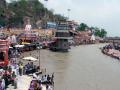
Rivers

Featured Articles
November 25, 2022 These maps at the watershed scales have been made to not only ensure inclusion of different freshwater ecosystems, their connectivity and hydrological processes, but can also provide a spatial context for conservation decisions.
A stream at Anini, Arunachal Pradesh (Image Source: Roshni Arora)
October 30, 2022 This book by Dr. Mitul Baruah presents a fascinating, ethnographic account of the challenges faced by communities living in Majuli, India, one of the largest river islands in the world, which has experienced immense socio-environmental transformations over the years, processes that are emblematic of the Brahmaputra Valley as a whole. This is an excerpt from the book.
Floods are recurrent phenomena in Assam (Image: Mitul Baruah)
October 11, 2022 In an effort to inform the general public, especially citizen activists, policymakers, researchers, and students, about the current status of the Vrishabhavathi river, Paani.Earth has created the necessary maps, data, analysis, and information to drive conservation awareness and action around the river.
Vrishabhavathi river (Image Source: Paani.Earth)
October 6, 2022 Rapid urbanisation and faulty land use policies are rapidly destroying forests, grasslands and wetlands in Jammu and Kashmir, India and the ecosystem value services they provide. Can these valuable ecosystems be saved?
Deteriorating ecosystems of Jammu and Kashmir, India (Image Source: tkohli at Flickr via Wikimedia Commons)
September 5, 2022 In an attempt to present a perspective on how rivers are used and abused, a map of the Bengaluru rivers illustrate how waste flows through natural river corridors, polluting the rivers and altering their status.
Vrishabhavathi river flow at Thagachguppe Bridge, Kumbalgodu (Image Source: Paani.Earth)
August 11, 2022 This could lead to water quality crisis reinforcing the need for basin-specific management strategies
Around the world, more than a fifth of nitrogen released by human activity ends up in aquatic ecosystems (Image: Wikimedia Commons)
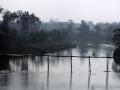
India's dykes on Kaliganga cause misery to Nepal
News this week: Nepal blames India for causing floods in former's territory; Study says Ganga is loaded with superbugs; Slowdown affects water use in Pune industries. Posted on 24 Feb, 2014 04:18 PM


India builds dykes on Kaliganga, causes misery to Nepal

Floods in Darchula in Nepal (Source: Wikipedia)
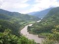
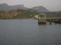
Scrap 15 out of 40 dams across Siang in Arunachal: CWC
Policy matter this week: CWC report warns against dams proposed in Siang; MoEF eases norms to clear dams in Sikkim; Karnataka all set to constitute groundwater authority. Posted on 24 Feb, 2014 04:17 PM

CWC recommends scrapping of 15 dams planned across Siang

A river in East Siang (Source: Wikimedia)
Invite to 'Aghanashini River Festival', Eco Watch, Uttar Kannada, Karnataka
The objective of the festival is to emphasize the importance of Western Ghats, which, along with the rainforests of South America help maintain the ecological balance of Earth.
Posted on 21 Feb, 2014 02:53 PM

Eco-Watch, Centre for Environment & Sustainable Development, based in Bangalore, and more active in North Karnataka, is organizing the event, namely “Aghanashini River Festival” at Aghanashini village situated on the bank of the River‘Aghanashini’ in Kumta taluk, Uttara Kanada district.

An alternative perspective: Sabarmati Riverfront Development
A critical review of the Sabarmati Riverfront Development project, Ahmedabad, from an environmental perspective. Posted on 20 Feb, 2014 01:09 PM

The Sabarmati Riverfront Development has been hailed as a project towards urban regeneration & environmental improvement, which will transform the river to a focal point of leisure and recreation.

Sabarmati Riverfront Development
Training Course on 'Application of NIH_ReSyP Software', National Institute of Hydrology, Roorkee
The main objective of this short-term course is to focus on the application of NIH_ReSyP software for analysis, operation, and management of reservoir systems.
Posted on 18 Feb, 2014 04:38 PM

The course intends to interact with field personnel engaged in reservoir operation and management in the country, and train them in the use of the software. A two-way interaction with the participants so that requirements of the field organizations are clearly identified, experiences are shared, and requirements for further modification and additional modules can be discussed.

Source: National Institute of Hydrology
New law to save the Ganga
Policy matters this week: PMO orders framing of draft legislation to protect the Ganga; Narmada-Kshipra river linking scheme passes the test; World Bank to support low-income states. Posted on 17 Feb, 2014 02:22 PM

PMO approves law to protect Ganga river

Ganga river in Haridwar (Source: Anoop Negi)
Sikkim achieves 100% sanitation under Nirmal Bharat Abhiyan scheme
News this week: Sikkim achieves 100% sanitation; Govt has only 2 months to cover 54.4% of rural India in its drinking water scheme; Maharashtra village gets community rights over dam reservoir. Posted on 17 Feb, 2014 02:21 PM

Sikkim achieves 100% sanitation

Sustainable sanitation
Red Hills reservoir leaks Chennai's water supply!
News this week: Chennai's Red Hills reservoir is leaking water; quantum of uranium in 'Thummalapalle' groundwater poses no threat to people; Kerala has the cleanest Anganwadi toilets. Posted on 10 Feb, 2014 04:49 PM

Chennai's drinking water seeps down the drain

A reservoir in Tamil Nadu (Source: Wikipedia)
Engineering witchcraft in Bihar
The Bhutahi Balan, a tributary of the Kosi may be a small river but it has caused immense devastation. Dinesh Mishra says that embankments aren't the answer to this problem. Posted on 09 Feb, 2014 07:46 PM

It's been years since Bhutahi Balan, a small tributary of the Kosi river in Madhubani, North Bihar, has been causing devastation on both its banks. Dinesh Mishra in his book 'Story of a ghost river and engineering witchcraft' objectively analyses the failure of embankments, which are raised banks to contain the river's flooding.

Devastation due to floods
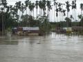
Land of water, no more
Tripura has 35,000 litres of water annually per capita. That is double that of the national average. So why are its people still facing water shortage? Posted on 02 Feb, 2014 10:11 PM

The name Tripura originated from 'Twi' meaning water and 'Para' meaning land. The indigenous population, which is about 32%, refer to Tripura as Twipra, meaning land of water. However, the state no longer seems to be living up to its name.

Soil erosion raises river beds in Tripura
×