Rivers
World Wide Fund for Nature-India invites applications for Programme Manager- Communications Rivers for Life, Life for Rivers, Delhi, Apply by June 30, 2012
Posted on 19 Jun, 2012 10:24 PM
WWF-India has been working to promote harmony between human beings and nature for more than four decades.Today, it is recognized as a premier conservation NGO in the country dealing with nature conservation, environmental protection and development-related issues. At a time when the Web of Life has come under increasing threats, WWF-India's attempts have been to find and implement solutions so that human beings can live in harmony with nature, and leave for future generations a world rich in natural resources and natural wonders.
Sarakki lake in Bangalore is almost dead and needs quick action to be revived
Posted on 07 Jun, 2012 04:39 PMSarakki Lake, also known as Jagaranahalli Lake located in South Bangalore is one of the oldest lakes in Bangalore, and once upon a time one of the most glorious. It has now become a reservoir for untreated sewage and a dumping yard for the surrounding neighbourhoods. This lake was a source of water for four villages up until just a few years ago.
Himmothan Pariyojana's drinking water and sanitation (WATSAN) interventions in Uttarakhand
Posted on 05 Jun, 2012 10:32 PMIn 2001, the Himmothan Pariyojana (HMP) programme was initiated to work on rural development issues in collaboration with the Government of Uttarakhand, as formalised by a 10-year MoU between the two in 2004.
Bihar floods - Causes and preventive measures
Posted on 01 Jun, 2012 12:21 PMBihar is surrounded by Nepal in the north, West Bengal in the east, Uttar Pradesh in the west and Jharkhand towards the south. There are several rivers that run through the state: Ganga, Sone, Punpun, Falgu, Karmanasa, Durgavati, Kosi, Gandak and the Ghaghara, to name a few. Nearly 85% of the state’s land is under cultivation.
Water quality index of surface water bodies of Gujarat, India - Paper published in the Asian Journal of Experimental Sciences
Posted on 25 May, 2012 10:51 PMThis paper from the journal Asian Journal of Experimental Sciences presents the findings of a study that attempted to assess the physicochemical parameters of surface water in Gujarat state to explore the suitability of water
Workshop on environmental flows, Himmotthan Society and International Rivers, June 8, 2012, Dehradun
Posted on 23 May, 2012 04:12 PMOrganisers: Himmotthan Society and International Rivers
Venue: Hotel Madhuban,
Rajpur Road,
Dehradun

![]()
"The Himmotthan Society works in the field of rural development in the Central Himalayan regions of Northern India. The various programmes of the Society reach approximately 900 villages across the northern states of Uttarakhand and Himachal Pradesh, directly involving over 50,000 families.
Since 1985, International Rivers has been at the heart of the global struggle to protect rivers and the rights of communities that depend on them. We work with an international network of dam-affected people, grassroots organizations, environmentalists, human rights advocates and others who are committed to stopping destructive river projects and promoting better options.
Water quality of the Bhagirathi, Ganga in the Himalayan region: A study by NEERI
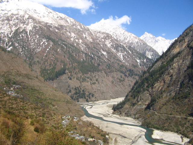
Posted on 19 May, 2012 05:00 PM The Bhagirathi in its upper reaches, here seen near Dharali (Photo: Chicu Lokgariwar)
Integrated hydrological data book (non-classified river basins) by Central Water Commission, Ministry of Water Resources
Posted on 15 May, 2012 08:37 AMThis data book published by Central Water Commission (CWC) is a compendium of impor
Water science in India - Hydrological obscurantism - A paper in Economic and Political Weekly
Posted on 07 May, 2012 12:15 PMThis article by Jayanta Bandyopadhyay in the Economic and Political Weekly deals with the Government of India’s proposal for addressing the twin problems of floods and water scarcity by interlinking rivers.
Resuscitating a failed idea - Notes from Bihar – A paper in Economic and Political Weekly
Posted on 07 May, 2012 11:36 AMThis article by Dinesh Kumar Mishra, Convenor of the Barh Mukti Abhiyan (movement for freedom from floods), Bihar in the Economic and Political Weekly states that the idea of a national interlinking of rivers needs to base itself on the past six decades’ experience of river and flood control measures.


