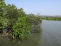
Lakes, Ponds and Wetlands


Estimation of rate and pattern of sedimentation and useful life of Dal Nagin Lake in Jammu and Kashmir - A research report by National Institute of Hydrology
Posted on 31 Jul, 2010 11:27 AMThe study determines rates of sedimentation and estimates the useful life of Dal-Nagin lake situated in Srinagar, Jammu and Kashmir using radiometric techniques. In spite of various ecological problems the lake is the largest freshwater lake in India. It has four major sub-basins viz., Hazratbal, Bod Dal, Garibal and Nagin. The lake is fraught with the problem of growth of underwater weeds and increasing rate of sedimentation.
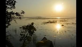
International training of trainers on wetland management 2011, Wageningen UR Centre for Development Innovation, The Netherlands
Posted on 30 Jul, 2010 10:34 AM![]()
Organizer: Wageningen UR Centre for Development Innovation
Topics:
- Concepts in wetland and river basin management
- Facilitation of multi-stakeholder processes
- Fieldwork wetland management
- Adult education and social learning
- Curriculum development
Waterlogged area mapping and hydrological data analysis of Mokama tal area – A research report by National Institute of Hydrology
Posted on 27 Jul, 2010 11:42 PMThe report presents waterlogged area mapping and hydrological data analysis of Mokama tal area of Bihar. The drainage problems of the agriculture land use are basically associated with the stagnation of runoff and the rise of the water table. Generally, the runoff stagnation is a result of intense rain, which produces excessive runoff for which the existing drainage capacity is not adequate or outlet conditions are not favorable. The rise of water table beyond a critical limit or surface ponding results in waterlogging conditions.
Protecting Pili river from land and pond encroachment
Posted on 27 Jul, 2010 02:50 AMdear all, I have sent several mail to concern department including minster jairam romesh regarding the Protecting PILI river , due to filling pond , taal , river land , dam to a river land encroachment in my village KOPA , Unfortunately, I still haven't received my reply .
Sedimentation study of Mansar lake in Udhampur – A research report by National Institute of Hydrology
Posted on 21 Jul, 2010 10:18 AMThe report presents a sedimentation study of the Mansar lake in Udhampur district situated about 55 kms east of Jammu at an elevation of 666 m above mean sea level in the Siwalik terrain. The lake surface area is 0.59 sqkm whereas the lake basin area is 1.67 sqkm. The maximum depth of lake is 38.25 m. The lake has been developed as a tourist spot of the region owing to its natural beauty. The water is also being used for drinking and irrigation purposes.
Modeling of surface runoff, infiltration and evapotranspiration – A research report by National Institute of Hydrology
Posted on 18 Jul, 2010 10:09 PMIn this study, a model has been developed considering surface flow component and subsurface flow component along with the evapotranspiration from the crop as the sink term for the Lokapavani area of KR Sagar command of Karnataka. The surface flow component is represented using one-dimensional St-Venant equations and the subsurface flow component is represented using one-dimensional Richards equation with the sink term for the evapotranspiration from crop.
Water balance of Sagar lake, MP – A research report by National Institute of Hydrology
Posted on 16 Jul, 2010 08:24 PMThe report presents a study on the Sagar lake wherein the various water balance components like inputs and outputs have been quantified to visualize the influence of these parameters on the storage changes. Lakes play an important role in shaping the hydrological, ecological and environmental balance of the region by developing the flora, fauna and habitation of the aquatic biota. Like other lakes, Sagar lake too faces manifold problems of siltation and deterioration of water quality, thus threatening its survival.
Inventory of water bodies of the Western Himalayan region – A report by National Institute of Hydrology
Posted on 16 Jul, 2010 07:54 PMThe report presents an inventory of water bodies in the State of Jammu & Kashmir in the Western Himalayan region prepared using satellite data of IRS-1A (standard FCC, scale 1:250000) for 1988/ 99 and digital data of IRS-1C for 1998. Also, presented is a database developed with the help of Survey of India (SoI) topographic maps, which includes name and type of the water body, nearest place, district, river basin, geographical coordinates and elevation.
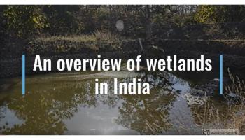
Draft regulatory framework for wetlands conservation - Comments by ATREE
Posted on 09 Jul, 2010 11:49 PMThe Ministry of Environment and Forests released a draft of the regulatory framework for wetland conservation - Wetlands Conservation and Management Rules (2009) for feedback from all stakeholders. The draft framework was prepared by a multi-disciplinary expert group, and final round of comments were invited till June 21st 2010.
The Wetland Conservation Team of Ashoka Trust for Research in Ecology and the Environment (ATREE) did a detailed analysis of the draft regulation and submitted several pertinent concerns to the Ministry. The most significant observation is that the new framework (as do much of India's policies and laws) continues to propose unjustifiable State control and interventions over the country's wetlands and livelihoods of people dependent on them. The regulation does not make any constructive suggestions or recommendations for the conservation that the country's wetlands demand, and instead brings all wetlands into complete official control by installing Central, State and District-level wetland regulatory authorities, wherein the majority of the members will be senior government officials.
Conservation of lakes - Myths and realities of desilting
Posted on 09 Jul, 2010 11:11 PMDesilting is becoming a major component of any Lake Conservation Project now a days. The basic reasons given for necessity of desilting are - increasing the storage capacity and checking eutrophic conditions.
As it is not practicable to reverse the slow process of silting in the bed of lakes through which only silt can be removed, there is no word like 'desilting' in any standard English dictionary. What we are doing in the name of 'desilting' is practically 'digging' or 'excavation' of lake bed. By so called desilting, the original lake bed is disturbed which has far reaching adverse effects on the performance of the lake. Most visible effect is the increase in percolation rate resulting in heavy seepage losses through the lake bed as observed after massive desilting at Pushkar lake in 2009.