Groundwater

"Water and The Laws in India": A book by Ramaswamy R Iyer
Posted on 12 Oct, 2009 03:16 PM Water is a complex subject that gives rise to many issues, and several of them have legal aspects. The book proceeds from various water-related problems and issues to the legal questions that arise in those contexts, examines the adequacy and appropriateness of the relevant existing laws, if any, and considers the changes and reforms that are needed. It seeks to cover the ground extensively. The book also briefly raises and explores the case for a constitutional declaration on water and an over-arching national water law. This compendious volume thus straddles two domains, viz.,
(i) water-resource policy, management, conservation, conflict-resolution, etc (in itself a multiple domain encompassing many concerns and disciplines); and
(ii) water law
How to conduct survey of water and sanitation: A reference toolkit by Arghyam
Posted on 08 Oct, 2009 02:03 PMIn 2008-2009 Arghyam conducted an extensive household survey of water and sanitation in rural Karnataka, covering 17,200 households and 172 Gram Panchayats.
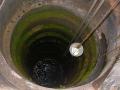
Groundwater scenario of Chidambaram taluk, Cuddalore district, Tamilnadu
Posted on 08 Oct, 2009 07:41 AMChidambaram is the taluk headquarters, located at about 250 km south of Chennai on east coast road [ECR] in Cuddalore district of Tamilnadu. It is a coastal taluk having three panchayat unions, Keerapalayam, Melbhuvanagiri and Portonovo. Chidambaram is the most important pilgrim center of the country, and is blessed with the Lord Nataraja temple. The temple town is also known as Bhuloka Kailash and Lord Nataraja, a cosmic dancer, represent the ‘Aakash’ form which is one among the ‘Pancha Boothas’.
Though this temple town is blessed with such historically important temple, the Nature has cursed Chidambaram area with brackish water, which is also one among the ‘Pancha Boothas’. The total aerial extent of this taluk is 649 square km and the most part of the taluk is confined between the rivers Vellar and Kollidam, which is a distributary of the river Cauvery. Some few lakhs years back the Kollidam river might have flown even north of Chidambaram town and might have receeded subsequently southwards to the present position. Due to this invasion, the entire area might have been changed as marshy lands and mangrove forests. The salinity of ground water may be attributable to the fluvio marine origin sediments, which might have been deposited during this paleo invasion by the river and due to the back water flow. Chidambaram is about 15 km west of sea shore and the mean sea level is 5.1 metres. Geologically this taluk is a sedimentary terrain and the eastern parts are covered by the quaternary unconsolidated formations of clay, black clay, soils, alluvium, silts, kankar and laterites of recent to sub recent age and the western parts by the tertiary formations of Mio-Pliocene age represented by litho units - sand stones, grits, clays with lignite seams and pebble beds.
Rain water harvesting to recharge bore wells?
Posted on 18 Sep, 2009 04:43 PMWE have a farm in Bangalore North, Hennur Road, with a number of borewells that have been unsuccesful or dried up. About 5 years back we built a dam across a Nalla (Natural erosion)in the farm, to collect rain water. The size of the Nalla is 300x20 ft approx with a water depth of over 7ft in good rainfall time. This year for the first time, thank God, it has not dried up.
Watershed scale planning- Application of rainwater harvesting techniques
Posted on 15 Sep, 2009 04:20 PMThe first project was conducted by the BAIF Development Research Foundation in the Hassan District of Karnataka. They created a linked network of 350 farm ponds covering 700 hectares of the watershed.
How to create a farm pond for water storage
Posted on 15 Sep, 2009 03:56 PMThe ideal farm pond should be dug into the ground in a naturally low-lying area. Some of the soil that is removed can be used to construct an earthen berm around the pond, which should be planted with trees and grasses for stability. The shade and wind protection provided by the raised mound and vegetation will reduce evaporative losses.
Groundwater recharge structures
Posted on 15 Sep, 2009 03:41 PM Where conditions are favorable, it is better to recharge the groundwater than to create surface ponds for storage. This approach minimizes evaporative losses, and often improves water quality. Recharge structures can be anything from a small pit simply dug into the soil, to a borewell converted for recharge. Recharge structures are useful in sloping landscapes where the water would not otherwise have time to sink into the ground before running off.
Tank Development - Design and features
Posted on 15 Sep, 2009 02:11 PMIf the intention is to develop a tank by holding back a large amount of water, then the dam must be carefully designed (with the assistance of experienced local people or engineers).
Techniques to slow runoff and erosion from steeply sloping land
Posted on 15 Sep, 2009 12:37 PM These techniques are useful to slow runoff and erosion from sloping land, and also to revegetate degraded areas. Areas with high rainfall, steep slopes, and thin soils should use slightly graded bunds / terraces / trenches to allow some drainage.