News and Articles
Long range forecast for 2011 South-west Monsoon season rainfall - Press release by IMD
Posted on 14 Jun, 2011 03:39 PMThe Long Period Average (LPA) of the south-west monsoon season rainfall over the country as a whole for the period 1951-2000 is 89cm. The first long range forecast for the south-west monsoon season (June-September) rainfall is issued in April and the forecast update is issued in June.
Tamirabarani, the perennial river in Tirunelveli district of Tamilnadu
Posted on 13 Jun, 2011 04:09 PMRiver Tamirabarani, a perennial river in Tirunelveli district of Tamilnadu. It originates from Pothigai hills in Western Ghat and drains at Punnaikayal afer running nearly 140 km. Its catchment gets rainfall during both SWM & NEM period. Ever year [or atleast once in every 18 month] the river is in full floods. During such period nearly 5000 cusec pure water is drained out to sea.
Godavari river water sharing accord - A paper by N. Sasidhar
Posted on 13 Jun, 2011 03:37 PMThe water availability in these projects has diminished to 33% dependability from the designed dependability of 75% in last nine years. Due to meager inflows, the river water quality is becoming unsafe for human and cattle consumption. It also suggests the remedial action to overcome the problem in future.
Accessing safe drinking water during floods in North Bihar
Posted on 13 Jun, 2011 03:23 PMThis season in the region is commonly referred to as – Barh (flood). For centuries local people have treated it as ‘a way of life’, and found ways to deal with it. Post independence, this ‘way of life’ gradually transformed into an assured annual devastation. The once self-sufficient communities in the flood plains have been relegated to being highly dependent on sources external to the village for their survival during floods.
Tearing through the water landscape: Evaluating the environmental and social consequences of POSCO project in Odisha, India - Release of a study by ESG
Posted on 09 Jun, 2011 08:03 PMArticle courtesy: Environment Support Group
On 2nd May 2011, Indian Environment and Forest Minister Jairam Ramesh finally approved the diversion of over 3,000 acres of forest land, of the 4,000 acres demanded, for a steel-power-port complex of the POSCO India project.
Earlier, on 31 January 2011, Ramesh had approved the environmental and coastal regulation zone clearances that the project had secured in 2007, even though all these clearances were obtained by fraud, and thus illegal, as proved by two independent investigative committees that he appointed last year.
Monsoon 2011 onset over Kerala - A meteorological analysis by IMD
Posted on 08 Jun, 2011 05:39 PMIndia Meteorological Department has objective criteria for declaring the onset of monsoon over Kerala.
Why Mumbai must reclaim its Mithi – A study by Observer Research Foundation
Posted on 08 Jun, 2011 05:05 PMThe river, along with its estuarine reach, provides the much-needed green lungs to the city in the form of mangroves. Neglect of this river was the main cause of the catastrophic floods in Mumbai on 26 July, 2005, which claimed nearly 1,000 lives. In what could be a monumental urban transformation initiative to be undertaken anywhere in India yet, ORF has proposed a grand vision for the reclamation of Mithi River. The study report and a documentary film ’Making the sewer a river again - Why Mumbai must reclaim its Mithi’ on the dreadful conditions of the river, was released in May, 2011 in Mumbai.
Tearing through the water landscape - Evaluating the environmental and social consequences of POSCO project in Odisha - A report by ESG
Posted on 08 Jun, 2011 03:34 PMBased on evidence from this inquiry, the study presents a critical analysis of the environmental and social impact information of POSCO's steel-power-port components to expose the fact that regulatory agencies have inadequate information on the short term and long term impacts of the project on the basis of the information that the company supplied to them. It also provides historical evidence
First-of-its-kind map depicts global forest heights - Update from NASA
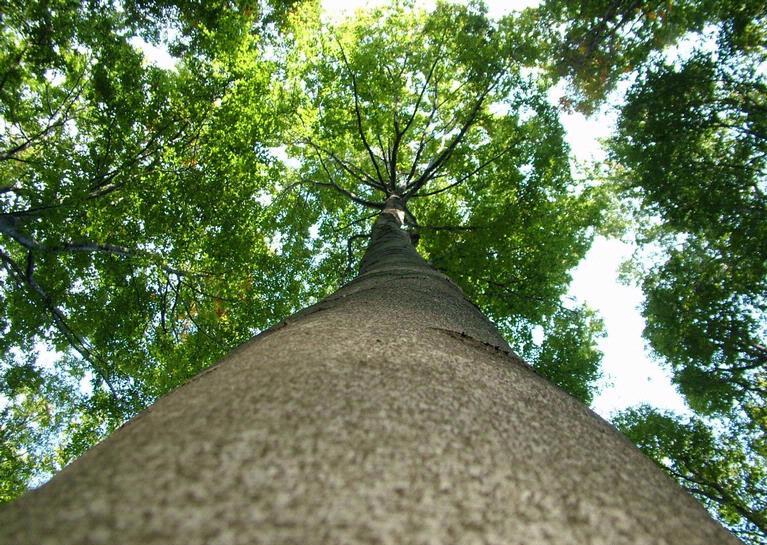
Posted on 08 Jun, 2011 10:54 AM European Beech
Photo: Forestryimages.org/University of West Hungary/Norbert Frank
Although there are other local-and regional-scale forest canopy maps, the new map is the first that spans the entire globe based on one uniform method.
The work - based on data collected by NASA's ICESat, Terra, and Aqua satellites - should help scientists build an inventory of how much carbon the world’s forests store and how fast that carbon cycles through ecosystems and back into the atmosphere. Michael Lefsky of the Colorado State University described his results in the journal Geophysical Research Letters.
Fluorosis in an urban slum area of Nalgonda - Andhra Pradesh - An epidemiological study - Indian Journal of Public Health
Posted on 07 Jun, 2011 10:09 AM.