Assam Valley
Of broken pots and dreams
Posted on 24 Sep, 2016 11:25 PMWomen in Salmora area of Majuli, the world’s largest riverine island and India’s first island district, practise their traditional form of pottery--the one that does not use a wheel but is hand beaten to shape and uses a viscid kind of clay. As the Brahmaputra eats away huge swathes of land year after year, the clay that these potters use is being taken away by the river.

Damming Bhutan affects India
Posted on 06 Jan, 2014 08:54 AMHydropower development in Bhutan has gained considerable ground as a sector capable of contributing to the development of the country. In 2012, Bhutan earned $177 million through energy export. However, these developmental activities are also prone to natural hazards like landslides since the region lies in a high risk earthquake prone zone and also registers heavy rainfall.

Free the river! Let it flow!
Posted on 25 Jul, 2013 12:46 AMFloods are an annual event in the north-eastern state of Assam. The newspapers expect it at this time of year, every year. For the world, this is routine, something not even worth a front-page story like the Uttarakhand floods maybe because it does not involve pilgrims or religion.

Exploring the spatial associations between census based socioeconomic conditions and remotely sensed environmental metrics in Assam, North East India – A study by Gary R Watmough
Posted on 23 Apr, 2012 01:50 PMPast studies have found associations between land and poverty, however these studies are usually focused on small areas using ground based studies.
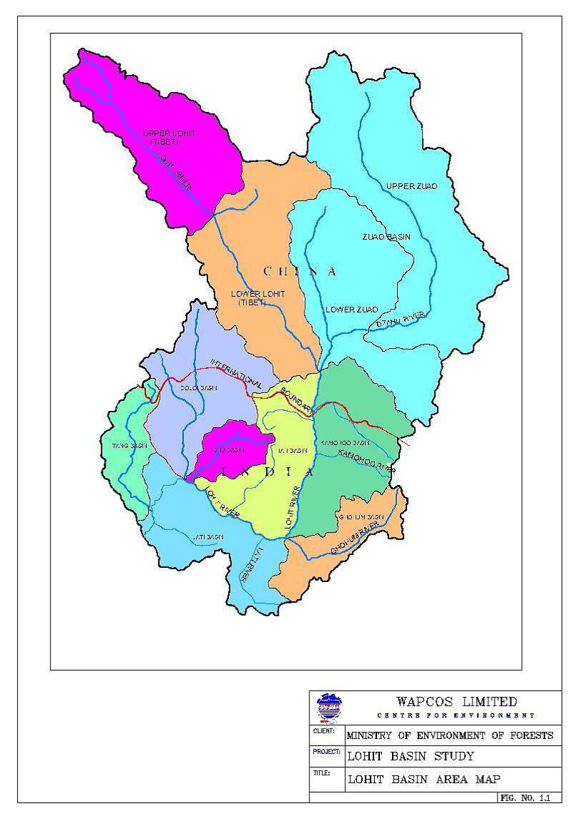
Basin-level impact assessment study of the Lohit river - A study by WAPCOS & Ministry of Environment and Forests (2011)
Posted on 19 Mar, 2012 11:29 AM
Multi-stakeholder dialogue is messy, but necessary
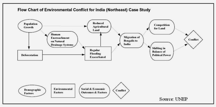
Posted on 16 Feb, 2012 01:32 PMA workshop on ‘Understanding and resolving water conflicts in the North East India', was organized by Forum for Policy Dialogue on Water Conflicts in India (Forum), in collaboration with Aaranyak (Guwahati), Centre for the Environment, IIT (Guwahati), Arghyam (Bangalore), SaciWATERs-CapNet Network (SCaN) and Cap-Net to discuss emerging issues related to water conflicts and their resolution in the region. This workshop was held in Guwahati on January 23-26, 2012. It aimed at presenting concepts and theory related water conflicts as well as issues especially relevant to the North East Region.

"Understanding and resolving water conflicts in the North East": Workshop held at Guwahati, 23-26 January 2012
Posted on 16 Feb, 2012 01:31 PMGuest post by: Raju Mimi
Adapting to climate change - Conserving rice biodiversity of the Apatani tribe in North East India - An IGREC working paper
Posted on 15 Feb, 2012 11:47 PMIt also deals with the threat to the biodiversity in the area due to climate changes and argues for the need to devise adaptation strategies at an urgent level to preserve the unique genetic variability of the region and the indigenous knowledge of farming practices in the area.
Hydropower in the Northeast: Potential and harnessing analysis - A critique
Posted on 15 Jan, 2012 11:41 PMThe main objectives of the hydropower study are as follows:
- An analysis of the hydropower potential in the Northeast and key elements of the strategy that should be followed for optimal realization of this potential
- An overview of the hydropower development options in the Northeast with regard to the water resources in the different river basins, including consideration of flood control and irrigation

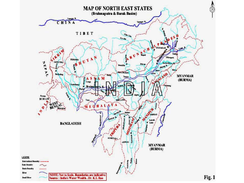
Map of the north-east states
Approach and achievements of individual water management by Dr Choudhury of Guwahati
Posted on 18 Jun, 2010 10:07 PMIn the recent past, Dr. Dipul Choudhury from Guwahati (Assam), managed to ensure rainwater harvesting arrangements in his newly constructed multistoried building at Tarun Nagar, Guwahati (Assam).