Surface Water


Sedimentation study of Mansar lake in Udhampur – A research report by National Institute of Hydrology
Posted on 21 Jul, 2010 10:18 AMThe report presents a sedimentation study of the Mansar lake in Udhampur district situated about 55 kms east of Jammu at an elevation of 666 m above mean sea level in the Siwalik terrain. The lake surface area is 0.59 sqkm whereas the lake basin area is 1.67 sqkm. The maximum depth of lake is 38.25 m. The lake has been developed as a tourist spot of the region owing to its natural beauty. The water is also being used for drinking and irrigation purposes.
Artificial recharging of an unconfined aquifer with an injection well in Ghataprabha sub-basin– A research report by National Institute of Hydrology
Posted on 21 Jul, 2010 08:47 AMThe report deals with the artificial recharging of an unconfined aquifer with injection well in the Hukkeri taluka in Ghataprabha sub-basin of Krishna river. The Ghataprabha sub-basin of Krishna like most river basins of peninsular India has been facing groundwater development problems varying in nature and severity. It has got a wide spectrum of issues such as cases of failure of wells at several places on the one hand, while some areas becoming unfertile due to waterlogging.
Environment flows - Continuing the discussion
Posted on 21 Jul, 2010 12:41 AM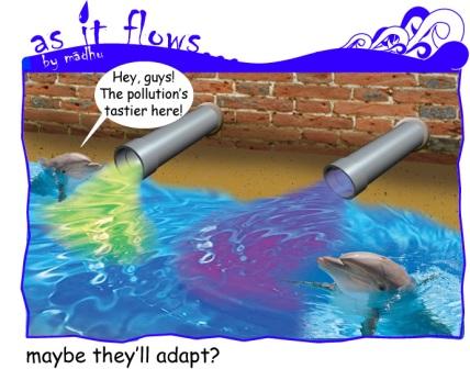
Watershed prioritization of Ukai dam catchment in Gujarat using remote sensing and GIS – A research report by National Institute of Hydrology
Posted on 20 Jul, 2010 08:29 PMIn the present study, watershed prioritization of the catchment immediately upstream of the Ukai reservoir has been carried out using remote sensing technique. The Watershed Response Model (WRM) has been used for this purpose. This model utilizes the Normalized Difference Vegetation Index (NDVI) and the Soil Brightness Index (SBI), the two important parameters responsible for soil erosion.
Dam break analysis of Ghodadoha project in Orissa – A research report by National Institute of Hydrology
Posted on 20 Jul, 2010 07:54 PM
Ghodadoha is a rock-filled earthen dam located in one of the tributaries of the Rushikuliya river of Orissa.
Rainfall-runoff modeling using Artificial Neural Network technique for Baitarni river in Orissa – A Research Report by National Institute of Hydrology
Posted on 20 Jul, 2010 07:21 PMThe research study attempts to develop a rainfall-runoff model using the Artificial Neural Network (ANN) technique for the Baitarni river in Orissa. A detailed review of the research work in the area of interest revealed that the approach of neural computations was very effective in developing the required model, due to its various advantages. Accordingly, three candidate models based on ANN architecture were developed for the study area, to represent rainfall-runoff transformation.
Raingauge network design for Pagladiya basin - A Research Report by National Institute of Hydrology
Posted on 20 Jul, 2010 08:02 AMIn the study, raingauge network design has been developed for the Pagladiya basin of Brahmaputra river in Nalbari, Assam and Bhutan. Precipitation is the most basic data required for any water resources study and the estimation of the number & location of raingauge stations that provide adequate information regarding rainfall falling over the catchment is referred to as network design. A raingauge network is intended to serve general as well as specific purposes such as water supply, hydropower generation, flood forecasting, irrigation and flood control.
Reservoir sedimentation study of Bargi dam using satellite data – A Research Report by National Institute of Hydrology
Posted on 20 Jul, 2010 07:47 AMThe study attempts to determine the useful life of the Bargi reservoir and assesses the sedimentation rate in it using satellite data. Periodical surveys are essential to provide a correct understanding of the sedimentation process going on in a reservoir, so that remedial measures can be undertaken well in advance and reservoir operation schedule planned for optimum utilization of water.
Development of conjunctive use model for lower Gandak basin – A Research Report by National Institute of Hydrology
Posted on 19 Jul, 2010 11:02 PMThe study attempts to develop a conjunctive use model involving judicious use of surface and groundwater for the Habibpur region of Gandak command in Bihar. The area is characterized by insufficient surface water during rabi and summer seasons and excess surface water in the kharif season.
Modeling of surface runoff, infiltration and evapotranspiration – A research report by National Institute of Hydrology
Posted on 18 Jul, 2010 10:09 PMIn this study, a model has been developed considering surface flow component and subsurface flow component along with the evapotranspiration from the crop as the sink term for the Lokapavani area of KR Sagar command of Karnataka. The surface flow component is represented using one-dimensional St-Venant equations and the subsurface flow component is represented using one-dimensional Richards equation with the sink term for the evapotranspiration from crop.