Rivers
Utility of fresh water flooded forests for large scale water harvesting
Posted on 18 Jan, 2011 03:16 PMThere are vast areas of fresh water flooded forests in Amazon River, Mekong River and Meghna River (Bangladesh) basins. In these flooded forests, the flora & fauna is richer than tropical ever green forests and many tree species grow more than 20 meters in height. These forests are inundated / submerged by river flood water up to ten meters depth for 5 to 7 months duration at a stretch.
Announcing the 2011 Kosi Fellowship
Posted on 31 Dec, 2010 02:12 PMForwarded to the portal by: Sudhirendar Sharma
Those activists, practitioners and journalists who have travelled in the Kosi River basin during 2008 (before the Kushaha breach), 2009 and 2010 have helped enhance our collective understanding on a manmade crises of gigantic proportions. Though not pre-planned, a unique fellowship on Kosi has indeed developed over these years. In their respective domains, each of the fellows have/are contributing to taking the key learnings across for better understanding on how our land, rivers and water ought to be managed (or not managed). The task, however, is far from finished.
High altitude wetland protected areas in western Arunachal Pradesh - Identification and demarcation using GIS
Posted on 27 Dec, 2010 11:15 PMGuest Post by Shashank Srinivasan
High altitude wetlands in the Indian Himalayas are crucial to the water security of downstream communities. They buffer the flow of glacial meltwater to sustain river flow in the dry season, ensuring that human settlements have access to water when they need it most.
High altitude wetlands are also reservoirs of biodiversity and contribute local livelihood opportunities. Identifying these wetlands and demarcating areas for their protection is thus crucial to any wetland management plan.
In this poster, a method of using topographic data obtained by remote sensing techniques, to identify the catchment areas of these wetlands has been described.
The author suggests that the protection of these catchment areas will ensure the survival of these wetlands, as well as of the communities that depend on them.
Guidelines for water safety plans for rural water supply systems by the Sulabh International Academy of Environmental Sanitation
Posted on 27 Dec, 2010 07:20 PMThis document by the Sulabh International Academy of Environmental Sanitation presents the guidelines for water safety plans for rural water supply systems. The revised National Rural Drinking Water Programme (NRDWP) Guidelines 2009-2012 issued by Rajiv Gandhi National Drinking Water Mission, Department of Drinking Water and Sanitation has shifted the focus from source development and installation of water supply system for providing drinking water supply to rural household to focus on development of village security plan.
Interlinking of Rivers - Third report of the Standing Committee on Water Resources (2009-2010)
Posted on 27 Dec, 2010 04:55 PMThis report of the Standing Committee on Water Resources deals with the action taken by the Government on the recommendations and observations contained in their Eleventh Report on “Inter Linking of Rivers” which was presented to Lok Sabha in October 2008.
Assessment of the status of environment and forest clearances of hydropower projects on river Mandakini – A report by MoEF
Posted on 27 Dec, 2010 02:08 PM This report by MoEF regarding the environmental impact of Phata-Byung & Singoli-Bhatwari hydro power projects on the river Mandakini deals with the additional safeguards and proper monitoring & supervision to help protect the environment in these project areas. It says that since a fairly large portion of the works has been taken up it may not be worth to abandon the project. It has proposed certain remedial measures to mitigate the damage if caused to the environment and local villagers.
The Phata-Byung and Singoli-Bhatwari hydro power projects, are Run of the River (RoR) projects on the river Mandakini. The series of RoR projects proposed and under construction as a part of cascade development are to generate electrical energy which is considered to be clean power as it is non-polluting and renewable in nature.
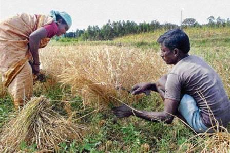
Water management lessons from the Nandi foothills - SRI technique involves less water
Posted on 27 Dec, 2010 11:10 AM This has resulted in a depletion of groundwater resources. There is a scarcity of drinking water too, in the region.
The Dam Safety Bill (2010) – Ministry of Water Resources
Posted on 27 Dec, 2010 11:00 AMThe Dam Safety bill, 2010 introduced in the Lok Sabha in August 2010 and approved by the cabinet earlier this year was referred to the Standing Committee on Water Resources, which was scheduled to submit its report within three months. The bill which is still pending seeks to provide for the surveillance, inspection and operation of all dams of certain parameters to ensure their safe functioning.
Evaluating and mapping of SCS Curve Numbers for Lokapavani catchment of Karnataka
Posted on 22 Dec, 2010 09:58 PMThis study by Geospatial World attempts to collect and analyse data concerning the catchment characteristics that affect direct runoff such as soil type, land cover and rainfall for the catchment of Lokapavani river in Karnataka using remote sensing and GIS techniques. An attempt has been made to determine the weighted average Curve Number (CN) for different land use, land cover and soil types in Lokapavani catchment in order to estimate the runoff.
Environmental compliance of hydel projects in Himachal Pradesh - Shukla committee report (2009)
Posted on 20 Dec, 2010 12:43 AMThe terms of reference for monitoring included the following:


