Glaciers and Polar Ice Caps
Recession and reconstruction of Milam Glacier in Kumaon Himalaya – A paper in Current Science
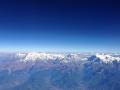
Posted on 18 May, 2011 07:29 PMHimalaya is one of the youngest mountain systems on Earth, and has a direct influence on the climate, hydrology and environment of the Indian subcontinent. It is the abode of one of the world’s largest and mostly inaccessible area of glaciers outside the polar region and provides glacier-stored water to the major Indian river basins. Many of the Himalayan rivers are fed by snow and ice melt run-off from snow fields and glaciers.
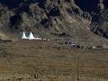
High altitude wetland protected areas in western Arunachal Pradesh - Identification and demarcation using GIS
Posted on 27 Dec, 2010 11:15 PMGuest Post by Shashank Srinivasan
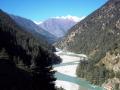
High altitude wetlands in the Indian Himalayas are crucial to the water security of downstream communities. They buffer the flow of glacial meltwater to sustain river flow in the dry season, ensuring that human settlements have access to water when they need it most.
High altitude wetlands are also reservoirs of biodiversity and contribute local livelihood opportunities. Identifying these wetlands and demarcating areas for their protection is thus crucial to any wetland management plan.
In this poster, a method of using topographic data obtained by remote sensing techniques, to identify the catchment areas of these wetlands has been described.
The author suggests that the protection of these catchment areas will ensure the survival of these wetlands, as well as of the communities that depend on them.
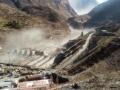
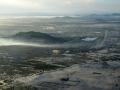
Formation of glacial lakes in the Hindu Kush-Himalayas and Glacial Lake Outburst Flood risk assessment - A report by ICIMOD
Posted on 19 Dec, 2010 05:17 PM This report by ICIMOD contains an assessment of the threat facing the Hindu Kush-Himalayan region from the recent (post-1950s) and rapid formation of meltwater lakes on the surface or at the end of a large number of the region’s glaciers owing to current climate warming. Individual case studies of the catastrophic outburst (glacial lake outburst floods or GLOFs) from such glacial lakes are introduced.
Relevance of Meltwater in River Basin Hydrology
Posted on 23 Jul, 2010 10:53 PMA peer paper in Science Magazine focuses on the core of a riverine system, the upstream basin, and its impact on the entire river basin.
Inventory of water bodies of the Western Himalayan region – A report by National Institute of Hydrology
Posted on 16 Jul, 2010 07:54 PMThe report presents an inventory of water bodies in the State of Jammu & Kashmir in the Western Himalayan region prepared using satellite data of IRS-1A (standard FCC, scale 1:250000) for 1988/ 99 and digital data of IRS-1C for 1998. Also, presented is a database developed with the help of Survey of India (SoI) topographic maps, which includes name and type of the water body, nearest place, district, river basin, geographical coordinates and elevation.
Study of suspended transport in the Dokriani glacier melt stream – A research report by National Institute of Hydrology
Posted on 15 Jul, 2010 12:17 AMThe report presents the status of the sediment studies carried out in the lower as well as higher altitude region of the Garhwal Himalayas. The processes associated with sediment production in the mountainous region have been described with an emphasis on the glaciarized region. Suspended sediment concentration and load observed in the Dokraini glacier melt stream near its snout has been computed.
Development of relationship between glacier melt runoff and meteorological parameters – A research report by National Institute of Hydrology
Posted on 10 Jul, 2010 04:35 PMThe study attempts to develop a relationship between glacier melt runoff and meteorological parameters for the Dokriani glacier in Garhwal Himalayas. The discharge auto-correlation, correlation between discharge & temperature and between discharge & rainfall has been computed for each month of the summer season and for the melt season as a whole for different years.
Sensitivity analysis of melt runoff due to temperature and precipitation – A research report by National Institute of Hydrology
Posted on 06 Jul, 2010 11:36 PMThe study aims to assess the impacts of various climate scenarios on the hydrological response of the high altitude Spiti river in the Himalayas. The climatic scenarios were constructed on the basis of simulations of the Hamburg coupled atmosphere-ocean climate model for the study region.
Snow cover estimation in Himalayan basins using remote sensing: A research report by National Institute of Hydrology
Posted on 21 Jun, 2010 04:37 PMThe study estimates the snow cover area for four major basins in the Himalayan region viz. Chenab up to Akhnoor, Ganga up to Devprayag, Satluj up to Bhakra and Beas up to Pandoh using IRS - IC and ID WiFS data. Snow cover estimation was done for the years 1997-2000 using image processing system ERDAS Imagine. The maximum and minimum snow cover extent for the month of September-October and March-April were delineated and on the basis of these the depletion curves for each basin was made for the four years. This output is useful for carrying out snowmelt runoff modeling.
Water Storage: A strategy for climate change adaptation in the Himalayas - A report by ICIMOD
Posted on 10 Apr, 2010 05:24 PM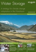 This report by the International Centre for Integrated Mountain Development (ICIMOD) highlights the phenomenon of climate change and argues that water storage will be a key strategy for climate change adaptation in the coming years.
The report discusses the importance of the Hindu Kush Himalayan ranges as an important source of water to a large section of the population and warns of the impending crisis of water scarcity and food insecurity in the regions of Asia, if water harvesting and conservation efforts are not undertaken. The document argues that water storage thus becomes a central issue, which is very complicated to implement, particularly in the Hindu Kush Himalayan region.