Ecology and Environment


The Himalayas – A presentation by ACWADAM
Posted on 24 Sep, 2010 10:38 PMThis presentation by ACWADAM deals with the Himalayan mountain system, the planet's highest, and home to the world's highest peaks. It specifically deals with the various divisions, the kind of structures present and the presence of groundwater in the massive mountain system.
Processes that shape the earth: II – A presentation by ACWADAM
Posted on 24 Sep, 2010 08:14 PMThe presentation deals with weathering, erosion and deposition of rocks -
- The process of breaking down and alteration of rocks and formation of new materials from them is known as weathering of rocks.
- The group of processes whereby the materials of the earth’s crust are moved from one place to another by running water (including rainfall), waves and current, glacier ice and wind is known as erosion.
- The processes whereby the material being carried during the process of erosion is deposited either through physical processes (such as drop in the velocity of flowing water) or precipitation of dissolved material under a set of conditions for instance, the deposition of limestones from water rich in calcium carbonate is known as deposition.
Hydrogeology and sanitation guidelines – A presentation by ACWADAM
Posted on 23 Sep, 2010 11:11 PMThis presentation by ACWADAM deals with hydrogeology and sanitation guidelines. Safe water supply and sanitation choices are an important public health measure and source quality improvement is critical to this. The impact of different aspects of water and sanitation appears to be largely dependent on the conditions within a particular community and existing access to other components of water and sanitation.
The structure of the sub-surface – A presentation by ACWADAM
Posted on 22 Sep, 2010 09:38 PMThis presentation by ACWADAM deals with the structure of the sub-surface. The lithology and structure of rocks together define the geometric framework for the movement of groundwater. To some extent, these factors also govern the movement of surface water too. In other words, the physical environment of rocks and rock material hosts water, and hence, controls its accumulation and flow in the watershed.
Importance of groundwater – A presentation by ACWADAM
Posted on 22 Sep, 2010 08:03 PMThis presentation by ACWADAM deals with the importance of groundwater. It is well-known fact that groundwater forms a very crucial source of water supply in the national scenario on water resources today. And yet, it continues to remain a resource that is both abused and misused. Often, watershed projects suffer from insufficient inputs, especially hydrogeological to address the problem(s) of groundwater within the watersheds.
Urban development - Mid-term appraisal of the eleventh five year plan - Report by the Planning Commission
Posted on 22 Sep, 2010 08:02 PMThe Eleventh Plan (2007-08 to 2011-12) sought to build on the gains achieved in the Tenth Plan and shift the economy to a path of faster and more inclusive growth. The Mid Term Appraisal (MTA) report for the Eleventh Five Year Plan 2007-2012 by the Planning Commission reviews the experience in the first three years of the Plan and seeks to identify areas where corrective steps may be needed.
Rural development - Mid-term appraisal of the eleventh five year plan - Report by the Planning Commission
Posted on 22 Sep, 2010 06:16 PMThe Eleventh Plan (2007-08 to 2011-12) sought to build on the gains achieved in the Tenth Plan and shift the economy to a path of faster and more inclusive growth. The Mid Term Appraisal (MTA) report for the Eleventh Five Year Plan 2007-2012 by the Planning Commission reviews the experience in the first three years of the Plan and seeks to identify areas where corrective steps may be needed.
Integrated Data Management Systems using Geographic Information Systems – A presentation by ACWADAM
Posted on 21 Sep, 2010 11:25 PMThis presentation by ACWADAM deals with integrated data management using Geographic Information Systems. A Geographic Information System (GIS) integrates hardware, software, and data for capturing, managing, analyzing, and displaying all forms of geographically referenced information.
Groundwater balance – A presentation by ACWADAM
Posted on 21 Sep, 2010 10:00 PM This presentation by ACWADAM deals with the subject of groundwater balance. It begins by describing the skeleton for the water balance equation viz., ground surface, soil, aquifer and bed rock. It describes the processes subsequent to rainfall such as interception, initial detention, depression storage, infiltration, runoff, streamflow, soil moisture retention and recharge.
The watershed water balance equation is explained in terms of input (rainfall and water transfers) and output (runoff, evapotranspiration and infiltration). It notes that the input to a generalized water balance is rainfall whereas the input to a groundwater balance is infiltration. The difference between infiltration & recharge, natural & artificial recharge and interflow & discharge are explained thereafter. The water balance for an aquifer may vary, depending upon the nature of groundwater system –
- Watershed with a deep aquifer
- Watershed has both shallow and deep aquifers
- Watershed has only shallow aquifer
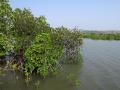
The deepest cut: Political ecology in the dredging of a new sea mouth in Chilika lake - Orissa (India)
Posted on 21 Sep, 2010 09:19 AMThis paper published in the journal Conservation and Society reassesses/debates the decision taken by the government to dredge a new sea mouth in the Chilika Lake in Orissa, India, which was based on Geographical Information Systems (GIS) studies.
The paper argues that decisions such as these need to be understood and evaluated by taking into consideration not only the underlying technical aspects, but by also exploring the political and historical contexts in which decisions are taken.