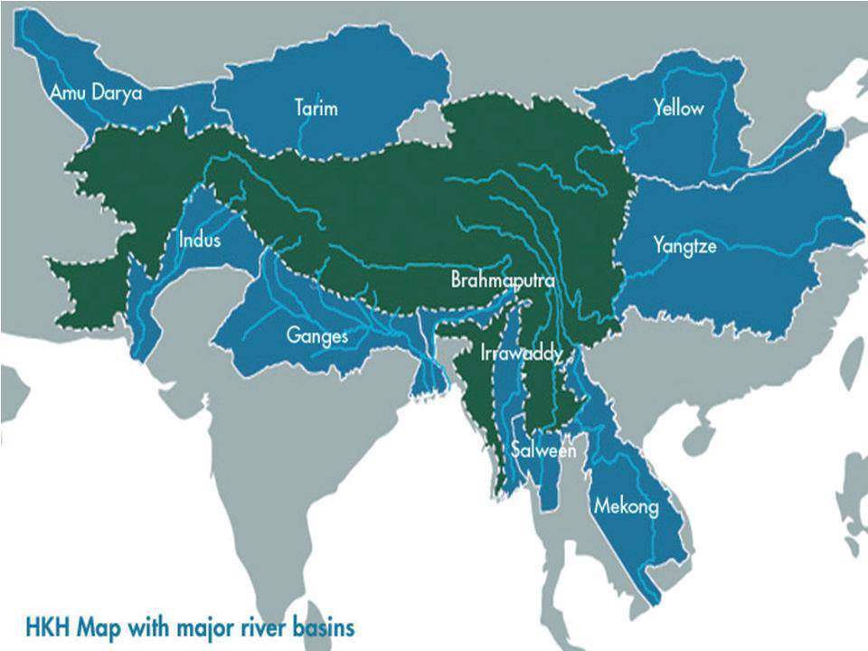
Meghna
Interdisciplinary approach to water management: From the uplands to the coast - The Ganges-Brahmaputra-Meghna Basin
Posted on 30 Dec, 2011 11:04 AMIn this paper, Jayanta Bandopadhyay explains the need for an interdiscipliinary framework for water resource management. He states that this framework needs to include ecological, social, economic and institutional perspectives. These perspectives are essential to facilitate cooperation over the management of transboundary rivers.

Water quality status of rivers in India – Report of Central Water Commission
Posted on 15 Jul, 2011 06:19 PMThe Level-I Laboratories are located at 258 field water quality monitoring stations on various rivers of India where physical parameters such as temperature, colour, odour, specific conductivity, total dissolved solids, pH and dissolved oxygen of river water are observed.
Eastern Himalaya freshwater biodiversity assessment report released by IUCN and Zoo Outreach Organisation
Posted on 18 Jan, 2011 11:44 PMDear all,
IUCN, with Zoo Outreach Organisation, have today published a new report, 'The status and distribution of freshwater biodiversity in the Eastern Himalaya', which is available online here
Damming North East India - Juggernaut of hydropower projects threatens social and environmental security of region
Posted on 28 Dec, 2010 07:49 PM This report by Kalpavriksh, Aaranyak and ActionAid India deals with the large dams’ juggernaut, which happens to be the biggest ‘development’ intervention in this ecologically and geologically fragile, seismically active and culturally sensitive region in the coming days. With the Northeast identified as India’s ‘future powerhouse’ and at least 168 large hydroelectric projects set to majorly alter the riverscape, large dams are emerging as a major issue of conflict in the region.
Although the current scale of dam-related developments far outstrips anything which took place in the past, the region has been no stranger to dam-related conflicts. For example, the Kaptai dam, built in the Chittagong Hill Tracts of East Pakistan (now Bangladesh) in the 1960s, submerged the traditional homelands of the Hajong and Chakma indigenous communities, and forced them to migrate into parts of Northeast India.
Effect of climate change on the Ganga-Brahmaputra delta regions
Posted on 28 Aug, 2009 02:28 PMThe delta belt is home to approximately 125-140 million people. And over 300 million people are supported by the delta. The density of population in the Delta region is 200 people / sq.km. making it one of the densest regions in the world.
The delta region is a high-rainfall region and receives 60-80 inches of rainfall every year.
Maps depicting the arsenic contamination in the Ganga-Meghna-Brahmaputra plains between 1976 and 2008
Posted on 20 Aug, 2009 06:11 PMThe School of Environmental Studies - Jadavpur University (SOES-JU), has done path-breaking research in reporting and documenting the issue of Arsenic contamination in the country.
River basins and river basin organisations in South Asia
Posted on 22 Jul, 2009 03:12 PMAs part of the research study, River Basins and River Basin Organisations in South Asia, done by the Society for Participatory Development Hyderabad, CapNet South Asia (Read More) and Gomukh Environmental Trust for Sustainable Development Pune (Click Here), data about individual river basins has been collected for the river basins in South Asia.
Groundwater Arsenic Contamination in the Ganga-Padma-Meghna-Brahmaputra Plain of India and Bangladesh
Posted on 01 Jun, 2009 04:20 PMGroundwater Arsenic Contamination in the Ganga-Padma-Meghna-Brahmaputra Plain of India and Bangladesh.This report from the Jadhavpur University highlights the intensity and magnitude of the arsenic contamination in the Ganga-Meghna-Bramhaputra plain which includes states Uttar Pradesh, Bihar, Jharkhand, West Bengal and Assam covering an area of 569,749 sq km.
Groundwater markets in Ganga-Meghna-Brahmaputra basin: theory and evidence - a review
Posted on 18 May, 2009 04:37 PMThis paper published in Economic and Political Weekly reviews 13 papers (from 1974 to 2003) on groundwater markets in the region, in order to understand the role of groundwater
Floods in Northeastern India - Images from NASA
Posted on 04 Nov, 2007 02:29 PM  Moderate Resolution Imaging Spectroradiometer (MODIS) on NASA's Aqua satellite captured images of flooded Brahmaputra River.