Brahmaputra
Damming North East India - Juggernaut of hydropower projects threatens social and environmental security of region
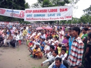
Posted on 28 Dec, 2010 07:49 PM This report by Kalpavriksh, Aaranyak and ActionAid India deals with the large dams’ juggernaut, which happens to be the biggest ‘development’ intervention in this ecologically and geologically fragile, seismically active and culturally sensitive region in the coming days. With the Northeast identified as India’s ‘future powerhouse’ and at least 168 large hydroelectric projects set to majorly alter the riverscape, large dams are emerging as a major issue of conflict in the region.
Although the current scale of dam-related developments far outstrips anything which took place in the past, the region has been no stranger to dam-related conflicts. For example, the Kaptai dam, built in the Chittagong Hill Tracts of East Pakistan (now Bangladesh) in the 1960s, submerged the traditional homelands of the Hajong and Chakma indigenous communities, and forced them to migrate into parts of Northeast India.
Raingauge network design for Pagladiya basin - A Research Report by National Institute of Hydrology
Posted on 20 Jul, 2010 08:02 AMIn the study, raingauge network design has been developed for the Pagladiya basin of Brahmaputra river in Nalbari, Assam and Bhutan. Precipitation is the most basic data required for any water resources study and the estimation of the number & location of raingauge stations that provide adequate information regarding rainfall falling over the catchment is referred to as network design. A raingauge network is intended to serve general as well as specific purposes such as water supply, hydropower generation, flood forecasting, irrigation and flood control.
Development of regional flood formula using L moments for north Brahmaputra river system – A research report by National Institute of Hydrology
Posted on 12 Jul, 2010 05:16 PMIn this study, an attempt has been made to develop a regional flood formula using L-moments for the north Brahmaputra river system. The annual maximum peak flood data of twelve gauging sites of the north bank tributaries of the river have been considered. The screening of the data has been carried out for assessing the suitability of the data for regional flood frequency analysis by computing the Discordancy Measure (Di) in terms of L-moments. Also, homogeneity of the region has been tested using the L-moment based heterogeneity measure, H.
Effect of climate change on the Ganga-Brahmaputra delta regions
Posted on 28 Aug, 2009 02:28 PMThe delta belt is home to approximately 125-140 million people. And over 300 million people are supported by the delta. The density of population in the Delta region is 200 people / sq.km. making it one of the densest regions in the world.
The delta region is a high-rainfall region and receives 60-80 inches of rainfall every year.
Maps depicting the arsenic contamination in the Ganga-Meghna-Brahmaputra plains between 1976 and 2008
Posted on 20 Aug, 2009 06:11 PMThe School of Environmental Studies - Jadavpur University (SOES-JU), has done path-breaking research in reporting and documenting the issue of Arsenic contamination in the country.
Map: Location of water resource projects across river basins in India
Posted on 20 Aug, 2009 03:23 PMThe map indicates that across the main 19 river basins of the country, water resource projects with a total live storage of 174 BCM (Billion Cubic Metres) have been completed, 75 BCM are ongoing, and 132 BCM are being planned.
Central Ground Water Board's hydrogeological survey of West Bengal
Posted on 12 Aug, 2009 01:26 PM
Courtesy: CGWB
The status of water resources in West Bengal: A report by Kalyan Rudra
Posted on 12 Aug, 2009 12:58 PMThe availability of water, water requirement versus supply, water requirements for some major crops, groundwater exploitation, growth of population, and declining per capita water in the state of West Bengal are presented.
River basins and river basin organisations in South Asia
Posted on 22 Jul, 2009 03:12 PMAs part of the research study, River Basins and River Basin Organisations in South Asia, done by the Society for Participatory Development Hyderabad, CapNet South Asia (Read More) and Gomukh Environmental Trust for Sustainable Development Pune (Click Here), data about individual river basins has been collected for the river basins in South Asia.
Groundwater Arsenic Contamination in the Ganga-Padma-Meghna-Brahmaputra Plain of India and Bangladesh
Posted on 01 Jun, 2009 04:20 PMGroundwater Arsenic Contamination in the Ganga-Padma-Meghna-Brahmaputra Plain of India and Bangladesh.This report from the Jadhavpur University highlights the intensity and magnitude of the arsenic contamination in the Ganga-Meghna-Bramhaputra plain which includes states Uttar Pradesh, Bihar, Jharkhand, West Bengal and Assam covering an area of 569,749 sq km.