India’s Himalayan rivers have been a cradle of civilisational development and a centre for faith and culture for ages. Ganga being a fertile basin has been a significant contributor to our agricultural economy as well as our river-based agrarian development. It cannot be visualised simply as a single river flowing through the northern states, but as a complex system of tributaries, main river and geological balances in alluvial geography.
Ganga basin is the largest river basin in India in terms of the catchment area, constituting 26% of the country's landmass (8,61,404 sqkm) and supporting about 43% of its population (448.3 million as per 2001 census). The river stemming from the Gangotri glacier at Gaumukh traverses a distance of 2525 km before flowing into the Bay of Bengal. A large number of tributaries like Alaknanda, Ramganga, Kali, Yamuna, Gomti, Ghagra, Gandak, Kosi and Sone, draining eleven states of the country join Ganga at different confluence points during its journey.
In recent years, the river has been in the limelight not for its abundant water flowing through the vast riverbed, but for the perilous state of the river. According to a study by the IIT-Kharagpur, Ganga, one of India's holiest rivers is drying up and has seen "unprecedented low levels of water in several lower reaches". It has been predicted that during non-monsoon months there will be hardly any flow in large stretches of the river from Varanasi to Kolkata in the coming years.
Findings from Amroha district, Uttar Pradesh

A major patch of the Ganga river lies in the state of Uttar Pradesh, where the main river straddles through its vast plains with the inherited flow from the north and further merger of tributaries contributing to its flow.
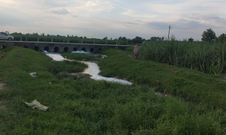
Amroha, a small district in Uttar Pradesh about 130 km from Delhi with a population of about 1.84 million has its western boundary demarcated by the river itself. Baand and Sooth are tributaries of Ramganga and sub-tributaries of Ganga which pass through Amroha. For the last 5 years, the flow of the river is reduced to a trickle and the river bed is mostly dry.
“These rivers used to be perennial in my childhood. They became seasonal in the early 2000s and are now completely dry in the last 5 to 10 years,” says Ajay Tandon, who runs a local NGO in Amroha.
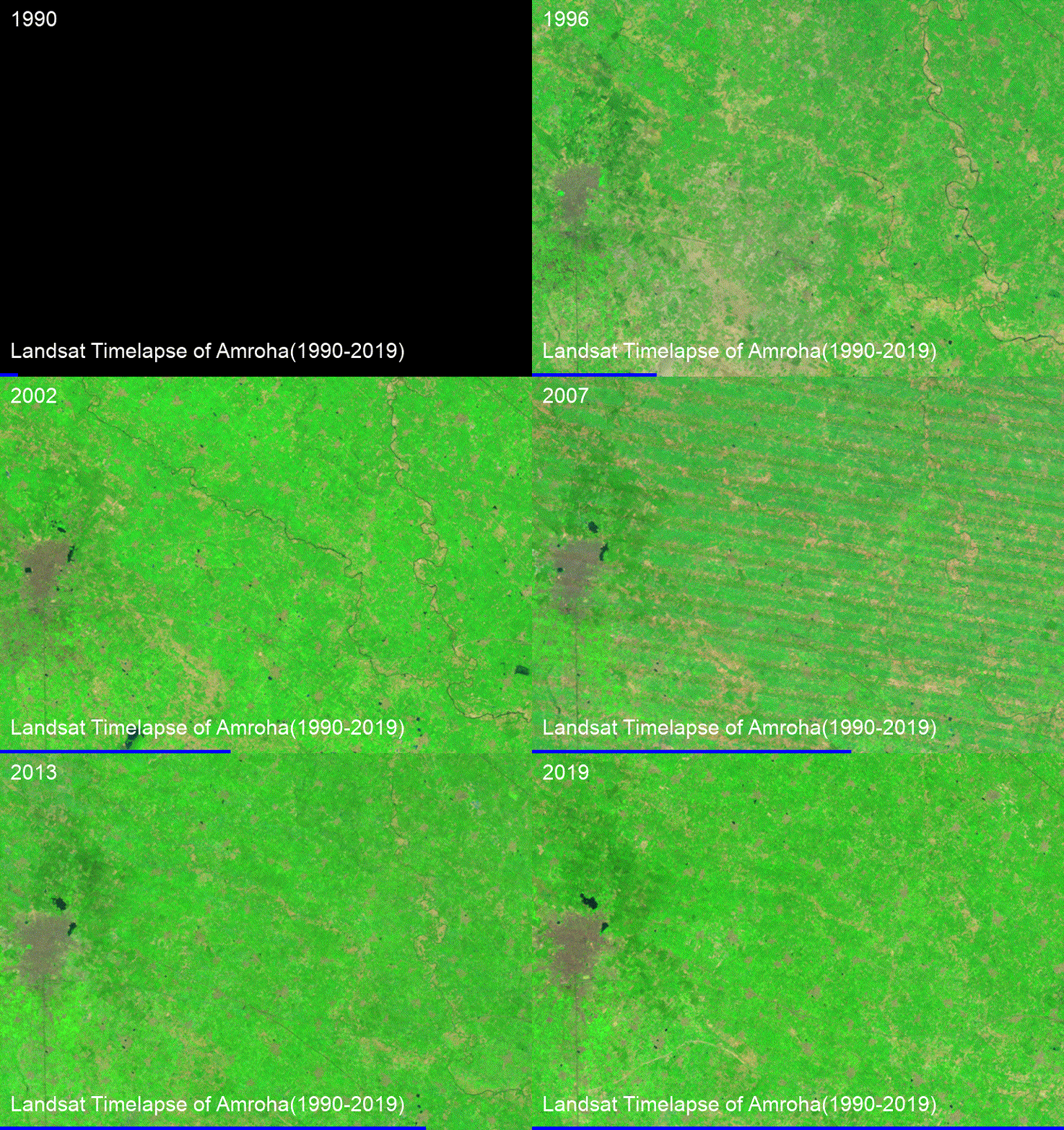
A look at the satellite images of Landsat and the GIF/video below shows that these two rivers have almost vanished in the latest satellite images.

What is siphoning the rivers in Amroha?
One major contributor to the siphoned flow is groundwater depletion. The rivers get their flow contribution through rainfall. Water flows in the river once there are saturated aquifers that create surplus water for surface flow after the monsoon.
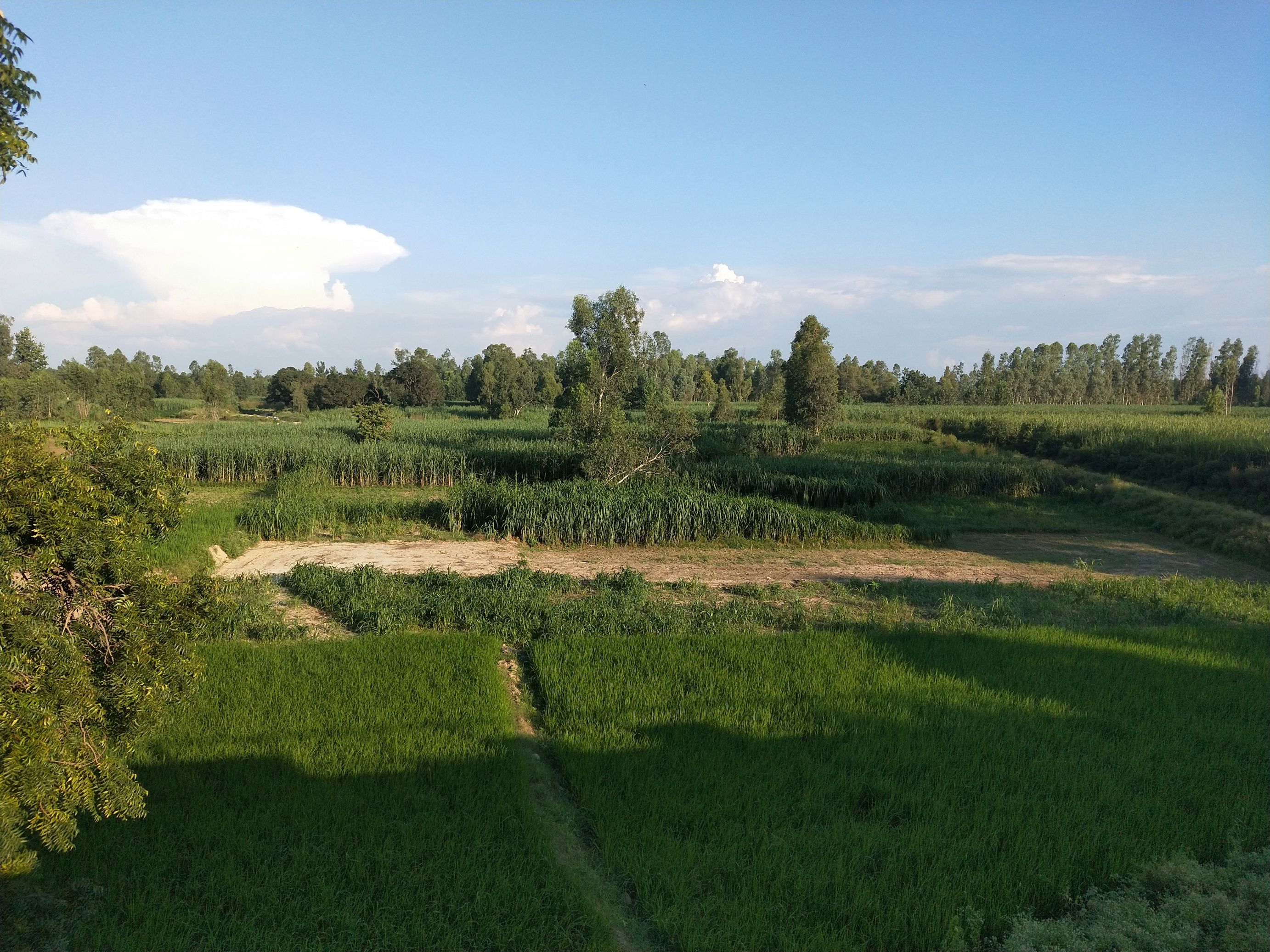
The area is marked by increasing population burden and irrigation water demand along with groundwater depletion in the alluvial aquifers of Amroha. The available porosity due to the depleted water table has created more room for rainfall to get saturated and has reduced the surface runoff that drains to the rivers.
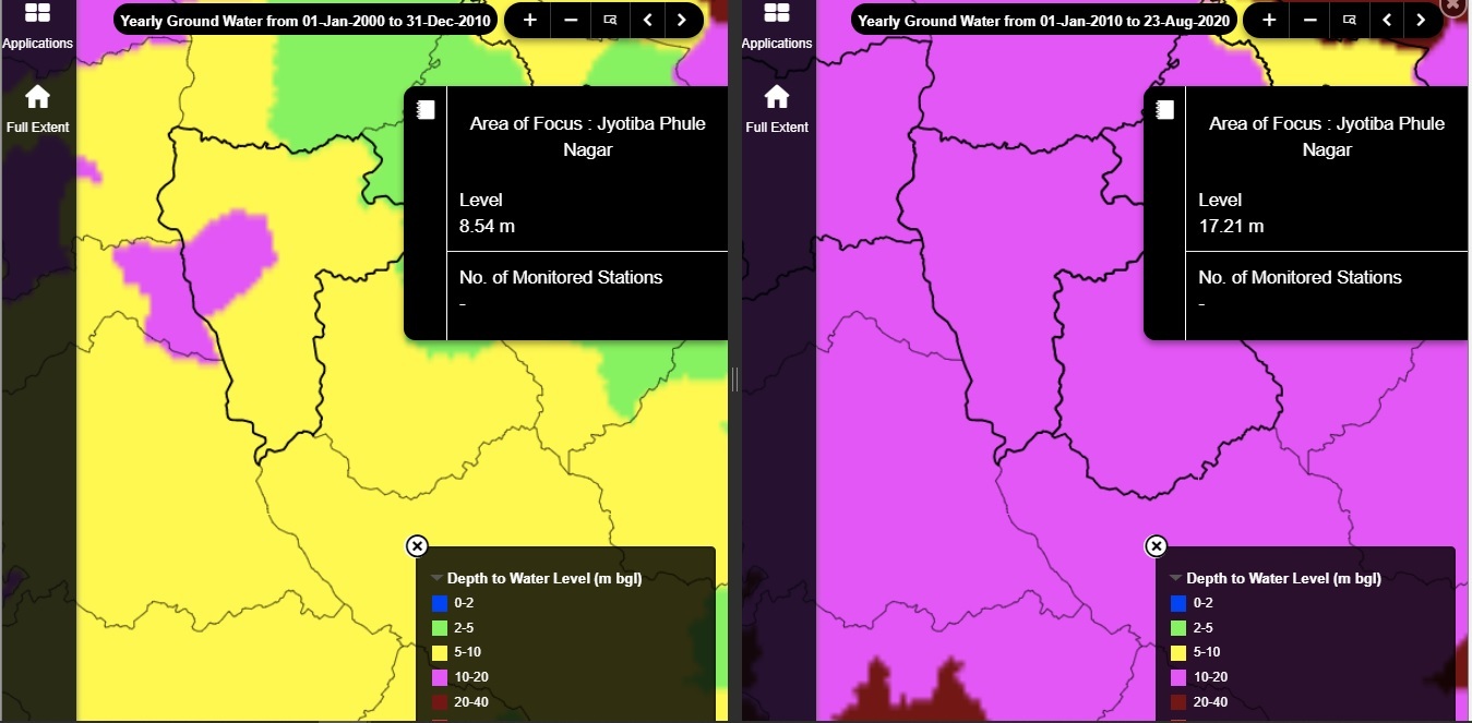
There is a sharp increase in water-intensive crops like sugarcane in the region which puts pressure on the groundwater. Changes in groundwater availability in Amroha for the last 10 years as per the Water Resource Information System (WRIS) shows that groundwater level has gone down by twice in 2020 (17.17 m) when compared to its level in 2010 (8.54 m) in Amroha.

On average, it is decreasing at the rate of about 1 m/year. Amroha is in the dark zone in terms of rate of decline in groundwater, the stage of groundwater development i.e., the ratio of groundwater extracted to annual replenishable groundwater available being 104.58 %.
Aviral Ganga for Nirmal Ganga
Ganga, one of the most sacred rivers of India is imbibed deeply in our culture and worshipped as a goddess. The high level of pollution in the river has been a major ecological threat and has been proactively taken up by the current government.
The massive diversion of the Ganga waters for irrigation has reduced the flow in the main river. Besides, there is reduced water flow from the tributaries that are drying due to heavy groundwater depletion and rainfall pattern changes, putting the burden on the existing path of the ‘Namami Gange Project’.
An article by Shah & Rajan (2019) argued that the clean Ganga (also termed as Nirmal Ganga) can be achieved quickly through the uninterrupted flow of the river (Aviral Dhara).
Adeel Khan is a recent graduate of Environmental Studies and Resource Management from the TERI School of Advanced Studies, New Delhi, and an alumnus of the St. Stephen's College. He has worked as an intern and research associate with several organisations such as Sustainable Development Solution Network (SDSN) Youth, German air quality start-up, UN organizations, NGO's and policy think tanks. His interest lies in data analysis and sustainable resource management.
Praharsh Patel is a Policy Researcher and works on the data-based evaluation of natural resources and developmental policies. He is co-founder and advisor of Prayaas: The Movement of Grassroot Changes, and Organising Team Member of Unleash Hacks Bharat. He is an alumnus of Massachusetts Institute of Technology, IIT Kanpur, and St. Stephen's College, Delhi.