Water is a vital natural resource, but continuous consumption of freshwater sources at an unsustainable rate will lead to a severe water crisis in the near future. Arid and semi-arid areas which include parts of Rajasthan such as Bhilwara are more adversely affected because of the quality, quantity, and uneven distribution of groundwater.
According to the Central Ground Water Board (2020-21) report, Rajasthan receives much lower rainfall than the other states of the country. A significant portion of rainfall at the beginning of the monsoon is utilised in the improvement of soil moisture or gets lost to evaporation because of the arid climatic conditions. Rainfall received by the Bhilwara district in 2020 is 580.88 mm, lesser than the average rainfall of 648.08 mm during the period (2011-20), as stated in the CGWB (2020-21) report.
Why does it matter?
Cattle rearing and agriculture are the traditional occupations of agro-pastoralist communities in the Mewar region that covers Bhilwara, Chittorgarh, Udaipur, and Rajsamand districts of Rajasthan. Gujjars, Jat, Rawat, Balai, and Kumawat communities constitute a significant population of the Baghmali (case study) village.
Big farmers have borewells and wells to undertake rabi and summer season cropping. But for most small and marginal farmers, the sowing becomes inconceivable during the year when the area has received less rainfall. Dependency is on commons surface water sources or public wells that mostly dry out during the peak summer months (May and June). Therefore, landless, socially and economically weaker households rely more on their livestock for sustenance. But how will the livestock survive without water?

Aggravated groundwater crisis
As Bhilwara falls in the Banas, Chambal, and Luni basins, there are no perennial rivers in the district. However, there are small streams that flow depending on the rainfall. In addition, groundwater in most of the blocks of the district remains significantly over-exploited as per a report of the Ministry of Water Resources (2013).
In the rural context, the overexploitation of groundwater is more critical because of its excessive usage in irrigation, particularly during the rabi season. The increased number of bore wells and mining of minerals such as granite along the Aravalli hills has negatively impacted the groundwater level over the years, decreasing the water table. The mining has aggravated the process of erosion caused by rain and wind, creating huge gaps in the line of peaks and posing a threat to the climate and the landscape serving as a wildlife corridor.
How will they do it - A case of Baghmali village
Baghmali is a village in the Asind Block of Bhilwara district predominantly resided by the agro-pastoralist communities. Around 70 per cent of farmers hold less than 5 acres of agricultural land, while just 1 per cent hold above 10 hectares.
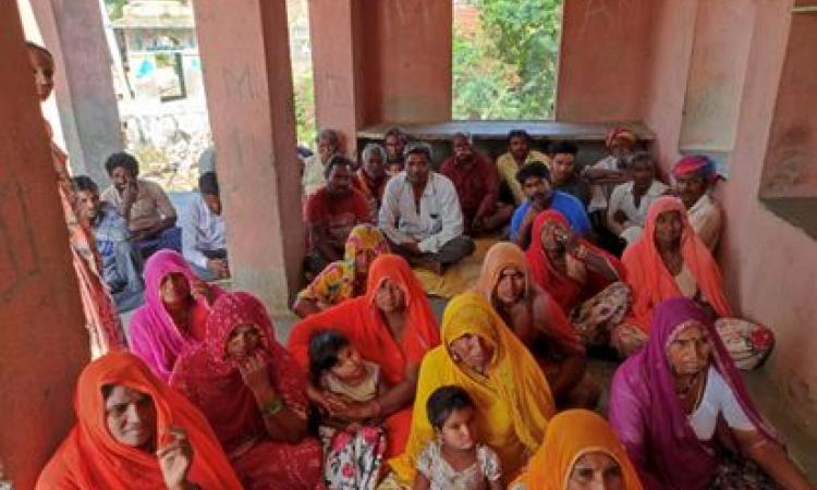
Based on the mixed group discussion with the community, it was pointed out that in 2021 farmers suffered a loss in the kharif season because of less and erratic rainfall. The sowing of maize was done following the first rain shower received in the last week of June. However, due to an extended dry spell for 20-25 days, most marginal farmers could not irrigate their standing kharif crop. The surface water bodies created under the MGNREGS scheme remained dry.
Considering this, the farmers addressed the domestic and drinking water needs of their cattle by purchasing water from tankers twice every month which would cost around Rs 300/tanker for 5000 litres of water.
Drawing on the discussions and information from secondary sources, Baghmali came under the water deficit area.
The discussion
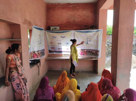
A debriefing session with the community was conducted to share, explain and collectively understand the potential reasons behind the current status of the availability and accessibility of groundwater sources in the village. The members engaged in the collective reflection session on their existing agricultural practices and the governance aspect of shared water commons.
- Topographical characteristics act as a limitation to cultivating less water-intensive crops: Few of the members suggested that even if they wish to sow barley (a less water-intensive crop) instead of wheat which requires at least seven irrigations, the soil type is such that it does not support the cultivation of barley on their fields. Therefore, they sow crops like wheat and mustard.
Weak governance mechanism: As regards maintenance of surface water sources, there are no rules concerning the prevention of dumping of waste near open water bodies. This brought them to think about the quality of water available for cattle in open water sources which might also affect their health.
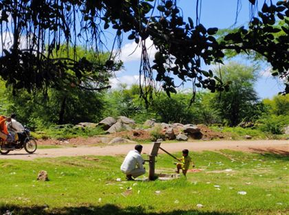
- Poor accessibility of water: It was learned during the interaction that most of the women participants are not in the habit of washing their hands before cooking or feeding their children below the age of 5 years which can serve as one of the potential causes of diarrhoea among children. The plausible reasons behind such practice could be the limited amount of accessibility of water in their houses, as women have to travel at least 2-3 km in multiple rounds carrying a pitcher to suffice the water requirements of their households which might instill the practice of not washing their hands very often.

"Assess and govern"
The discussion led the group further engage on how they should participate in the planning process of the annual MGNREGs budget at the Gram Panchayat and further propose the construction of cattle drinking structures in a place which is easily accessible to everyone. On the aspect of crop selection for the Rabi season, farmers were sceptical about whether the sowing of Rabi crops would be possible considering erratic/less rainfall received in the year 2021, apart from a few exceptions such as big farmers who own wells to irrigate their fields.
The water security assessment process involved the participation of the community in the Baghmali village in recognizing the existing gaps in the governance and accessibility of ground and surface water. The awareness-building through information sharing made them realise that they have to adopt sustainable water management practices and strengthen their participation in planning and governance of shared common resources for the coming generations to prevent the situation of migration.
Assessing the village’s existing status of ground and surface water sources, its geography, the risk factors and the magnitude can provide a perspective to the actors and concerned stakeholders to understand the critical nature of water as a shared natural resource and design strategies to manage and conserve.
About the author
Ishita graduated with her Master of Arts in Development from Azim Premji University, Bangalore. For almost two years, she has been associated with FES (Foundation for Ecological Security) and working closely with the rural-local communities of Rajasthan and Gujarat in the landscape of the Aravalli toward forest and grassland conservation.