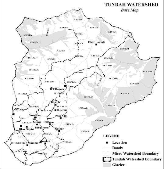
 This paper published in the journal International Journal of Remote Sensing and GIS presents the findings of a study that attempted to study the quantitative geomorphological analysis of a watershed of Ravi river basin in Himachal Pradesh, India. Morphometry is the measurement and mathematical analysis of the configuration of the earth's surface, shape and dimension of its landforms. A major emphasis in geomorphology over the past several decades has been on the development of quantitative physiographic methods to describe the evolution and behavior of surface drainage networks.
Morphometric analysis of a watershed provides a quantitative description of the drainage system, which is an important aspect of the characterisation of watersheds. Remote sensing and GIS techniques are currently used for assessing various terrain and morphometric parameters of the drainage basins and watersheds, as they provide a flexible environment and a powerful tool for the manipulation and analysis of spatial information
The study revealed that remotely sensed data i.e. CartoSAT-1 DEM and GIS based approach in evaluation of drainage morphometric parameters and their influence on landforms, soils and eroded land characteristics at river basin level was more appropriate than the conventional methods. GIS based approach facilitated analysis of different morphometric parameters and helped to explore the relationship between the drainage morphometry and properties of landforms, soils and eroded lands.
Different landforms were identified in the watershed based on CartoSAT-1 DEM data with 2.5m spatial resolution, and GIS software. GIS techniques characterised by very high accuracy of mapping and measurement proved to be a competent tool in morphometric analysis. The morphometric analyses were carried out through measurement of linear, areal and relief aspects of the watershed with more than 53 morphometric parameters.
The morphometric analysis of the drainage network of the watershed showed dendritic and radial patterns with moderate drainage texture. The variation in stream length ratio was thought to be due to change in slope and topography. The bifurcation ratio in the watershed indicated normal watershed category and the presence of moderate drainage density, suggesting that it had moderate permeable sub-soil, and coarse drainage texture.
The value of stream frequency indicated that the watershed showed positive correlation with increasing stream population with respect to increasing drainage density. The value of form factor and circulator ration suggested that Tundah watershed was less elongated to oval. Hence, from the study it was concluded that CartoSAT-1 (DEM) data, coupled with GIS techniques, proved to be a competent tool in morphometric analysis.
A copy of the paper can be accessed at this link