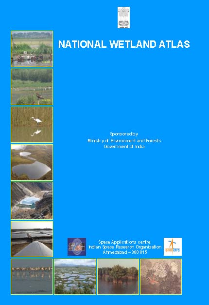
 This book by Space Applications Centre (SAC), Indian Space Research Organisation (ISRO) is an outcome of the project on National Wetland Inventory and Assessment (NWIA) . Increasing concern about how our wetlands are being influenced had led to formulation of the project entitled to create an updated database of the wetlands of India.
Wetlands defined as areas of land that are either temporarily or permanently covered by water exhibit enormous diversity according to their genesis, geographical location, water regime and chemistry. They are one of the most productive ecosystems and play crucial role in hydrological cycle. Utility-wise, wetlands directly and indirectly support millions of people in providing services such as storm and flood control, clean water supply, food, fiber and raw materials, scenic beauty, educational and recreational benefits. Thus, their identification and protection becomes very important.
The wetlands have been categorised under nineteen classes and mapped using satellite remote sensing data from Indian Remote Sensing Satellite: IRS P6- LISS III sensor. The results are organised at 1: 50,000 scales at district, state and topographic map sheet (Survey of India reference) level using Geographic Information System (GIS). This publication is a part of this national work and deals with the wetland status of a particular State/Union Territory of India, through text, statistical tables, satellite images, maps and ground photographs.
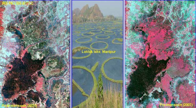
 Loktak Lake, Manipur
The atlas comprises wetland information arranged in to nine sections. How the NWIA project work has been executed is highlighted in the first six sections viz: Introduction, NWIA project, Study area, Data used, Methodology, and Accuracy. This is the first time that high resolution digital remote sensing data has been used to map and decipher the status of the wetlands at national scale. The methodology highlights how the four spectral bands of LISS III data (green, red, near infra red and short wave infra red) have been used to derive various indices and decipher information regarding waterspread, turbidity and aquatic vegetation. Since, the aim was to generate a GIS compatible database, details of the standards of database are also highlighted in the methodology.
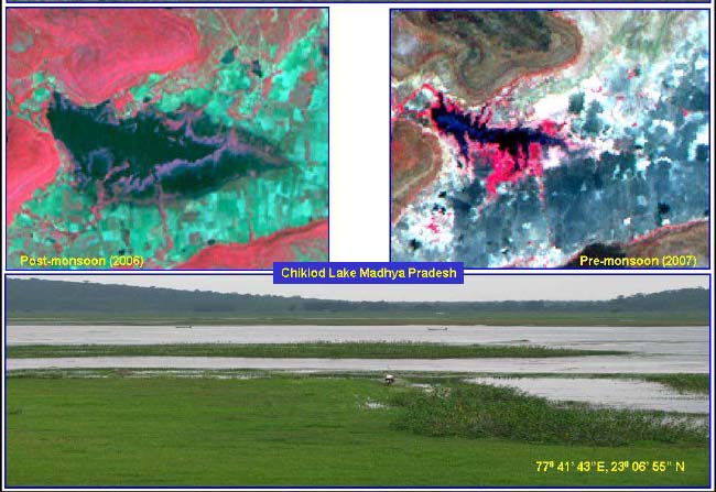
The results and finding are organized in three sections; viz: Maps and Statistics, Major wetland types, and Important Wetlands of the area. The Maps and Statistics are shown for state and district level. It gives details of what type of wetlands exists in the area, how many numbers in each type, their area estimates in hectare. Since, the hydrology of wetlands are influenced by monsoon performance, extent of waterspread and their turbidity (qualitative) in wet and dry season (post-monsoon and pre-monsoon period) are also given. Similarly the status of aquatic vegetation (mainly floating and emergent types) in two seasons is also accounted for.

Chiklod Lake, Madhya Pradesh
Status of small wetlands are also accounted as numbers and depicted in maps as points. Wetland map also show important ancillary information like roads/rail, relevant habitations. False Colour Composite (FCC) of the satellite image used (anyone season) is shown along with the derived wetland map to give a feeling of manifestation of wetlands in remote sensing data and synoptic view of the area. The status of some of the important wetlands like Ramsar sites, National Parks are shown with recent field photographs. The total wetland area estimated is 10.002 Mha (excluding rivers).
This atlas also provides database of high altitude wetlands nestled in the Himalayas at different elevation ranges. This National Atlas highlights results of this work in terms of statistics, maps, satellite images, field photographs etc. for the entire country and hopes to improve our understanding of the dynamics and distribution of wetlands and their status in the area.
Download the atlas below -
National Wetland Atlas - An updated database of wetlands in India by MoEF, 2011 (100 MB)
The Wetland Atlas is also available for each state / union territory -
- Andaman and Nicobar Islands - Wetlands Atlas - MoEF (2011)
- Andhra Pradesh - Wetlands Atlas - MoEF (2011)
- Arunachal Pradesh - Wetlands Atlas - MoEF (2011)
- Assam - Wetlands Atlas - MoEF (2011)
- Bihar - Wetlands Atlas - MoEF (2011)
- Chattisgarh - Wetlands Atlas - MoEF (2011)
- Delhi - Wetlands Atlas - MoEF (2011)
- Goa - Wetlands Atlas - MoEF (2011)
- Gujarat - Wetlands Atlas - MoEF (2011)
- Haryana - Wetlands Atlas - MoEF (2011)
- Himachal Pradesh - Wetlands Atlas - MoEF (2011)
- Jammu and Kashmir - Wetlands Atlas - MoEF (2011)
- Jharkhand - Wetlands Atlas - MoEF (2011)
- Karnataka - Wetlands Atlas - MoEF (2011)
- Kerala - Wetlands Atlas - MoEF (2011)
- Lakshadweep - Wetlands Atlas - MoEF (2011)
- Madhya Pradesh - Wetlands Atlas - MoEF (2011)
- Maharashtra - Wetlands Atlas - MoEF (2011)
- Manipur - Wetlands Atlas - MoEF (2011)
- Meghalaya - Wetlands Atlas - MoEF (2011)
- Mizoram - Wetlands Atlas - MoEF (2011)
- Nagaland - Wetlands Atlas - MoEF (2011)
- North East - Wetlands Atlas - MoEF (2011)
- Orissa - Wetlands Atlas - MoEF (2011)
- Punjab - Wetlands Atlas - MoEF (2011)
- Rajasthan - Wetlands Atlas - MoEF (2011)
- Sikkim - Wetlands Atlas - MoEF (2011)
- Tamil Nadu - Wetlands Atlas - MoEF (2011)
- Tripura - Wetlands Atlas - MoEF (2011)
- Union Territories - Wetlands Atlas - MoEF (2011)
- Uttar Pradesh - Wetlands Atlas - MoEF (2011)
- Uttarakhand - Wetlands Atlas - MoEF (2011)
- West Bengal - Wetlands Atlas - MoEF (2011)